Since the New Year’s holiday, south Florida has been getting steady “swings” in weather. That doesn’t mean conditions have necessarily been active, but temperatures have definitely been bobbing back and forth. Most recently, Wednesday’s wake up readings (chilly for us) ranged from the upper 40’s in Perrine to mostly the lower 50’s across the rest of the south Florida mainland. By sunset, skies were partly cloudy ahead of a final cool night for this week.

Chilly high pressure continues to span across the deep south, including the entire Florida peninsula. It’s forcing winds down from the north.
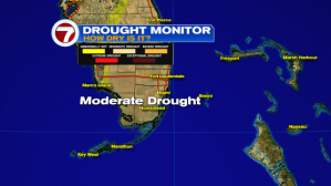
A northerly air flow not only leads us to a “cold connection” but also sends very dry air into the region. While it’s comfortable air with low humidity (and allows us to give air conditioners a rest) it can be a problem when it comes to brush fire concerns. Already, prior to this week, south Florida was under a Moderate Drought due to the lack of rain and very dry brush.
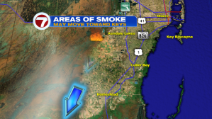
On Wednesday afternoon, multiple brush fires were reported close to Krome Avenue. Fortunately, firefighters were able to get an upper hand on the activity fairly fast. Associated smoke was being pushed southward, in the general direction of the Florida Keys, by late Wednesday.
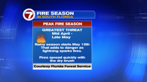
It seems were getting a fast start on the upcoming Fire Season. Typically, conditions get worse into March and beyond. According to the Florida Forestry Service, the most threatening time (in which we’re most vulnerable for brush fires popping up and spreading) is from late April through May.

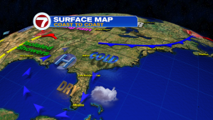
Looking ahead at our local weather for the foreseeable future, the late week pattern includes the main change of high pressure slowly drifting away. As the high loses its grip on the region, another cold front will approach from the northwest. Most forecast maps suggest the timing of the front coming after Sunday (which will probably be the warmest day of the stretch). The front could bring some beneficial rain to the area, on Sunday. Upon the passage of the frontal boundary on Martin Luther King Jr. Day (Monday) we’ll get another round of cooling for the holiday. Jackets may be necessary for a couple nights, at least, until temperatures moderate again.
