Happy Friday, South Florida!
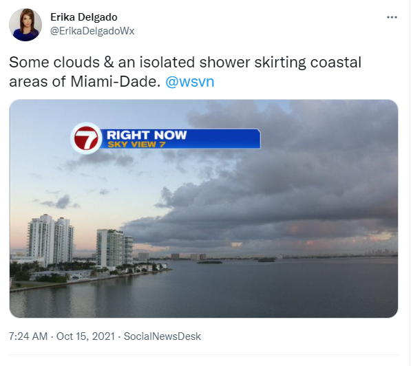
Hopefully everyone had a great week! The weather across our area has been quite nice the last few days despite the fact that there have been some showers around. Today marks the last day of the rainy season in South Florida and it looks like we will end the season with showers surrounding our peninsula. That’s what we saw earlier this morning across all of our local waters while temperatures this morning were once again pleasantly mild in the 70s.
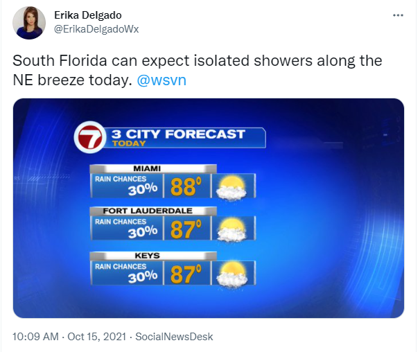
High pressure is slowly regaining control of our weather pattern while drier air continues to move in across our area. At the surface, we still find a Northeast wind, which means showers will be possible along the breeze coming in from the Atlantic from time to time. So for today we will leave isolated showers in the forecast while afternoon high temperatures once again reach into the upper 80s. This will leave our temperatures a few degrees above average across South Florida once again.
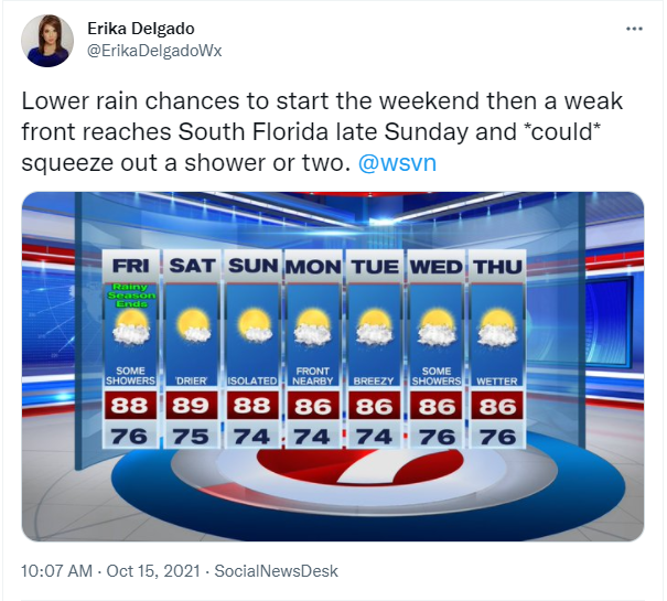
Nice changes look to push through our area for the first day of the dry season in South Florida – today. Slightly drier air is forecast to move across South Florida at some point later today and linger into the start of the weekend. This will help keep rain chances on the lower end of the scale at least through much of the weekend. And while rain chances will still remain lower on Sunday, we could see a few more showers as a front begins to drop south across our state and eventually reaches us late in the day on Sunday. It is still unclear whether this front stalls over our area or if it will completely clear us. Depending on the whereabouts of the front, South Florida could be seeing better rain chances as we head into next work week.
Have a great weekend!
Erika Delgado
Meteorologist
WSVN Channel 7 News
Copyright 2024 Sunbeam Television Corp. All rights reserved. This material may not be published, broadcast, rewritten or redistributed.