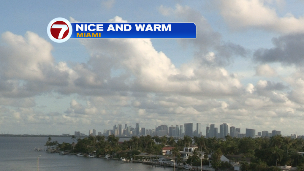
South Florida temperatures are sizzling as you’d expect in June. However, we’re actually catching a bit of a break “to some degree”. The break includes passing clouds (mixing in with our sunshine) which provides helpful shade. Also, a breeze off the ocean helps take the edge off the heat and humidity. Here’s a nice view of Miami from Monday afternoon.
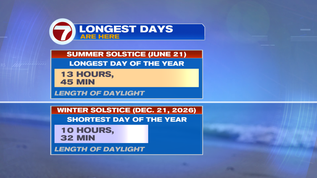
We’ve reached the time of year when there’s more daylight. How much? Almost 14-hours as we approach the summer solstice, on June 21. Shown below, you can see the dramatic difference between June and December days in south Florida! At the end of the year, daylight is limited to just over 10-hours and a half.
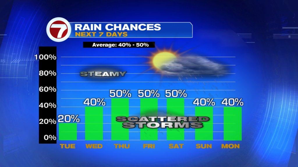
High Pressure is the main weather feature into Florida. Actually, there’s a “holding high” over the western Atlantic and upper level High extending into Florida from the Gulf. In this setup, it limits rainfall because of the stable and sinking air effect.
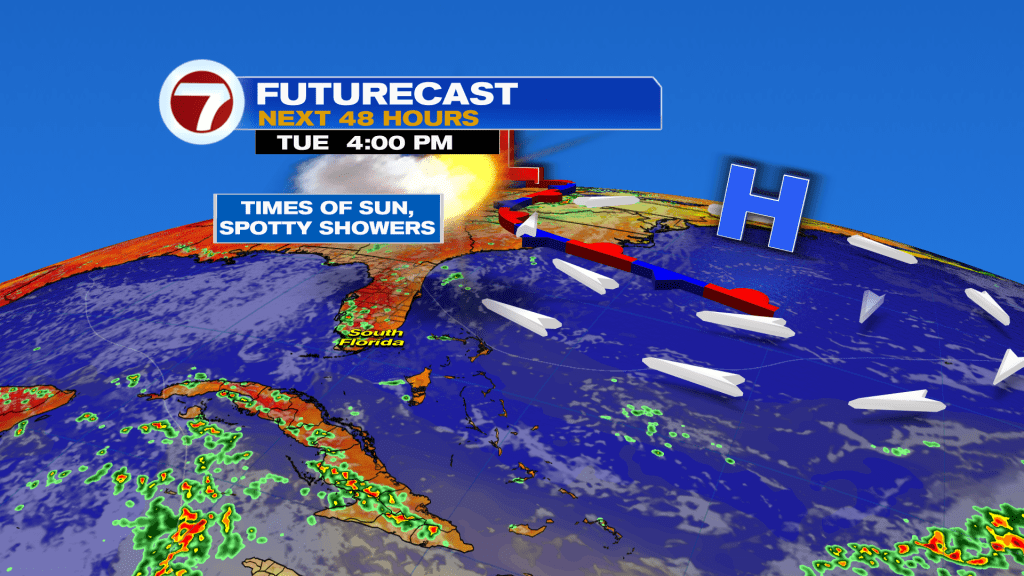
As we get deeper into the week we’ll see High Pressure slip away. The surface High (Atlantic) moves farther east while the upper High (Gulf) retreats west. The result will be an increase in tropical moisture. We’ll connect into Caribbean moisture, even though the main shield seems to spread from the Yucatan towards the western Gulf and Texas.
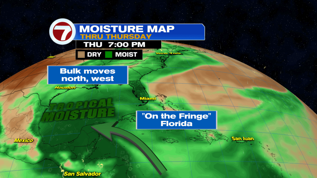
With this pattern, starting Thursday, rain and storm chances will be on the rise. A big slug of moisture fans out and south Florida will plug into more unstable air (although it could be worse if the moisture blob was simply spreading north). If you’re thinking ahead to the weekend, chances will be near seasonal for rain and we can’t rule out some heavy downpours.
Copyright 2026 Sunbeam Television Corp. All rights reserved. This material may not be published, broadcast, rewritten or redistributed.