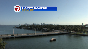
Easter Sunday began a sunny stretch for south Florida and the clear conditions continue into the start of the work week. Here’s a look at the bright sky that made for a beautiful holiday.
Dry and stable weather expands far from Florida, meaning we’ll actually get a prolonged period with high pressure over us.
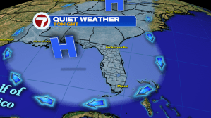
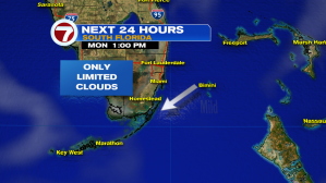
Ocean air is flowing into south Florida. Local winds are coming from the northeast as humidity is “kept in check”. Enjoy the nice and pleasant weather with temperatures running slightly below average.
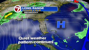
How long can this pattern last? A glance at the Wednesday weather map shows high pressure is drifting away (north of the Bahamas). It’s still close enough to remain in control. As it makes a greater exit, though, winds will turn out of the south later this week. That will draw up tropical air and moisture. Rain prospects look decent into Friday and Saturday, especially as a disturbance approaches Florida from the Gulf of Mexico.