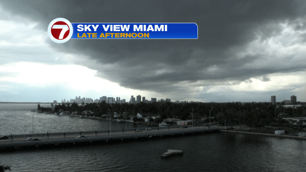
We’re at the peak of “two seasons” and that means our weather is both very steamy and extra stormy. The South Florida Rainy Season and the “hot weather season” is at a boiling point (at this juncture in August)! As we saw on Sunday, conditions can quickly go from sunny to stormy. Here’s a look at the late afternoon sky as a heavy downpour was poised to move over Miami.
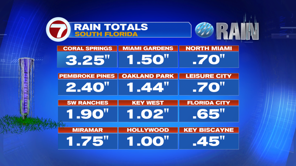
Miami-Dade County wasn’t as wet as Broward, on Sunday. Check out the impressive rain totals for Pembroke Pines and Coral Springs!
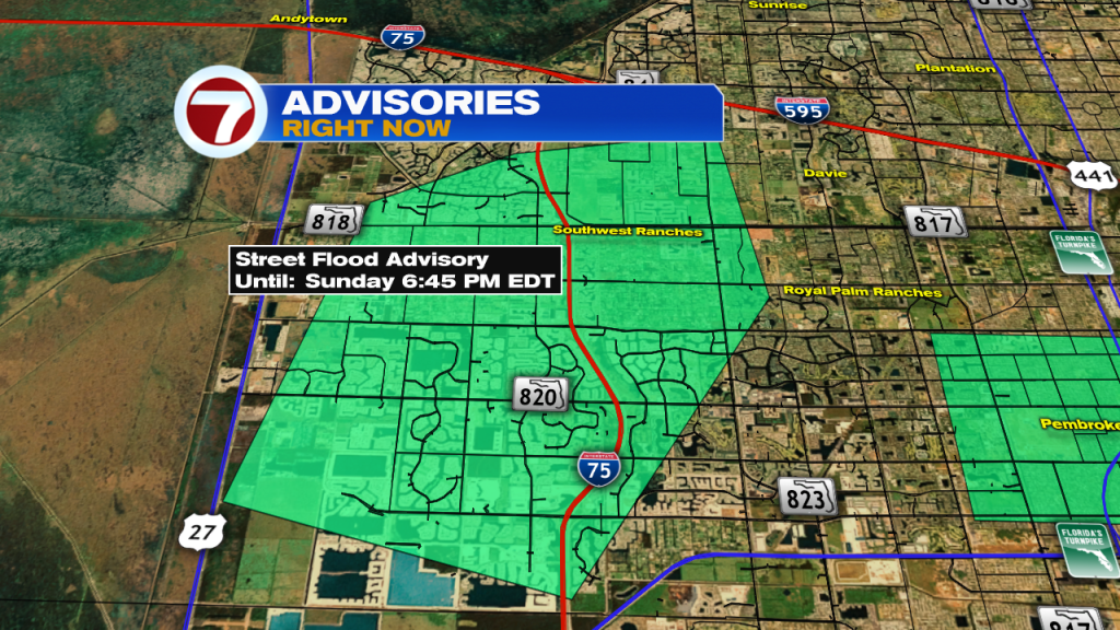
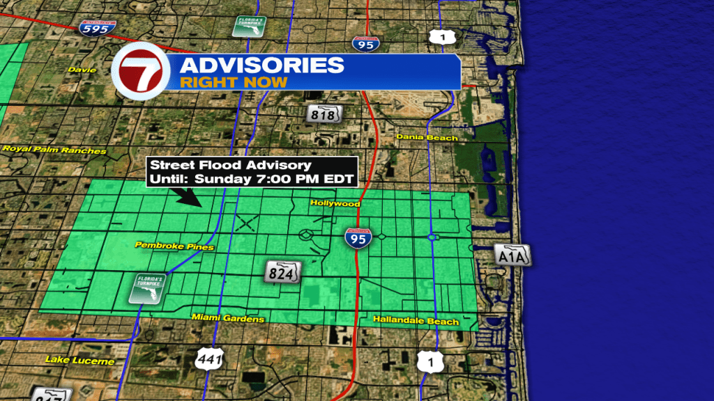
The heavy, slow moving storms prompted this Street Flood Advisory for the western suburbs of Broward. Shortly after it was issued, another advisory was needed for much of southern Broward, too.
As the work week begins, we’re left with some of the same weather features around us. That means weak high pressure is directing southerly winds (with lingering tropical moisture overhead). During the day, then, Sea Breeze storms get activated. Steering winds are primarily from the SW, so thunderstorms will target much of the southeast coast (later in the day).
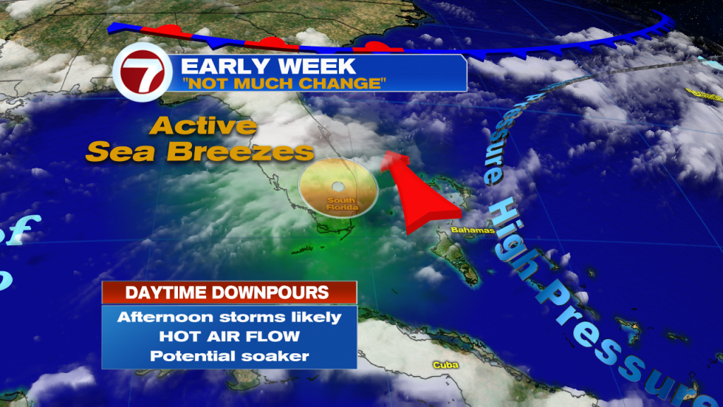
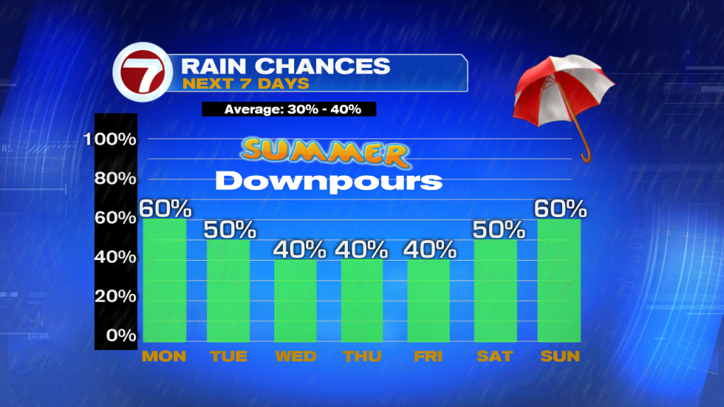
With so much recent rain, we’ll have to watch for more days with potential flooding. Overall, rain chances are expected to stay slightly higher than usual.