Related
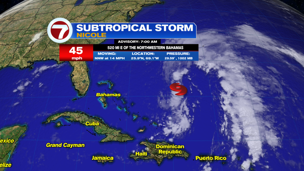
Subtropical Storm Nicole forms East of the Bahamas and it is aiming for Florida.
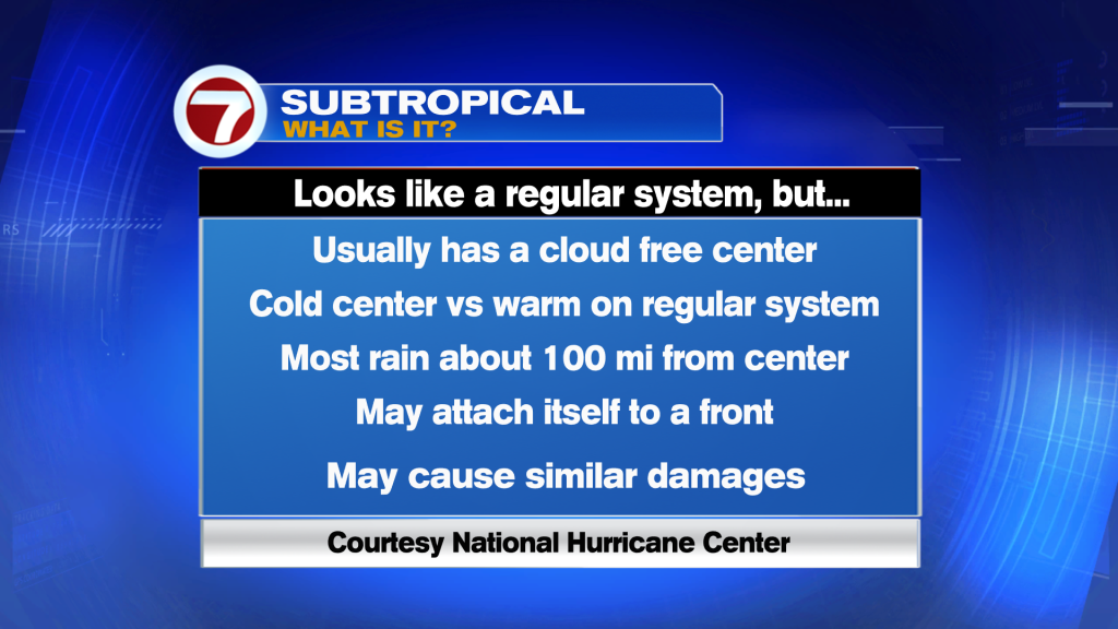
What is a subtropical system? They look like a regular system, but it has a cold center versus warm on a regular system. most of the rain is about 100 miles removed from the center, and these type of systems may attach itself to a front. However, they cause similar damages in comparison to a regular tropical system.
High pressure is forecast to nudge Nicole to the West and it is expected to slow down. On the forecast track, the center of Nicole will approach the Northwestern Bahamas on Tuesday, move near or over those islands on Wednesday just shy of hurricane status.
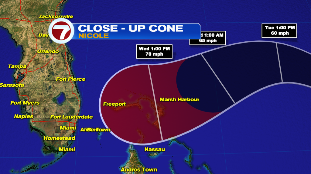
Then it will approach the East coast of Florida on Wednesday night into Thursday morning. Therefore, everyone in the shaded area in red should be watching the progress of Nicole closely.
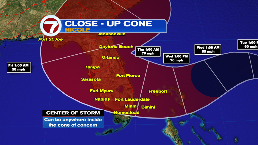
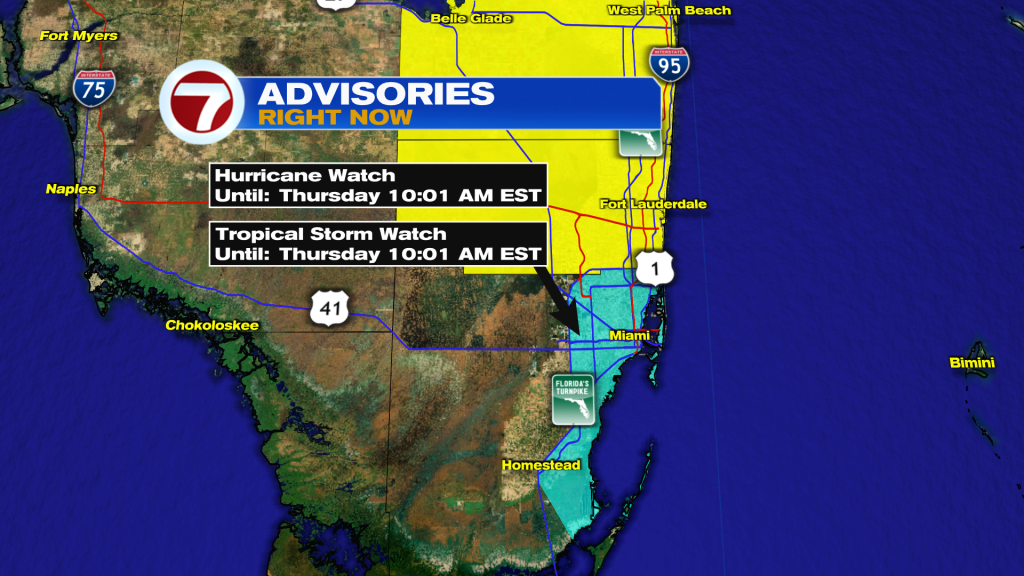
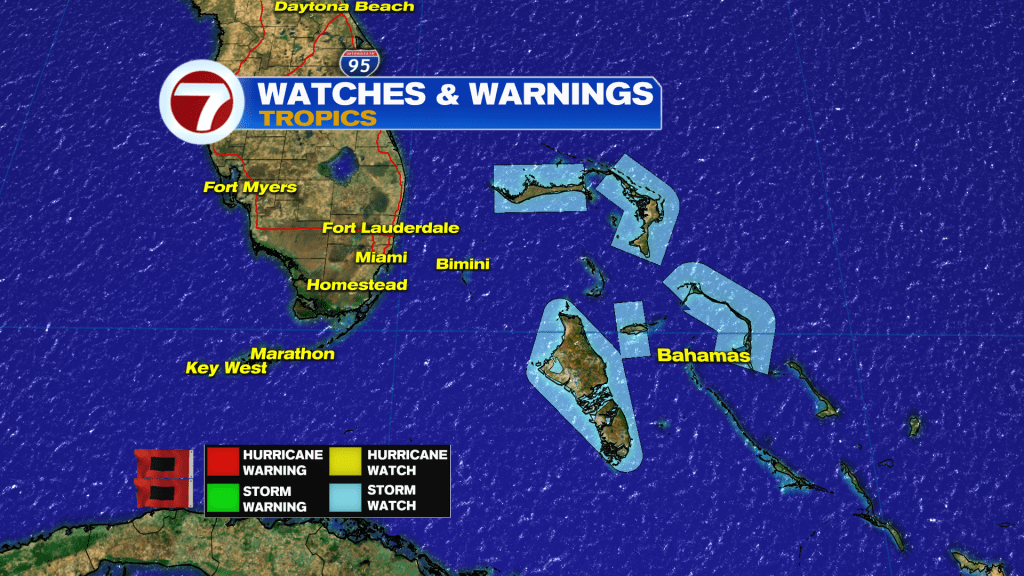
The Northwestern Bahamas are under a Tropical Storm Watch and since there is an increasing risk of at least tropical-storm-force winds and flooding rainfall for portions of South Florida by Wednesday and now a Hurricane Watch has been issued for Broward and Tropical Storm Watch for Miami-Dade.
Also, a Storm Surge watch was issued for areas South of Hallandale Beach to North of Ocean Reef.
There is an increasing risk as well of seeing significant coastal impacts including, coastal flooding, high seas, rough surf, and beach erosion along portions of the Florida East coast through most of the week.
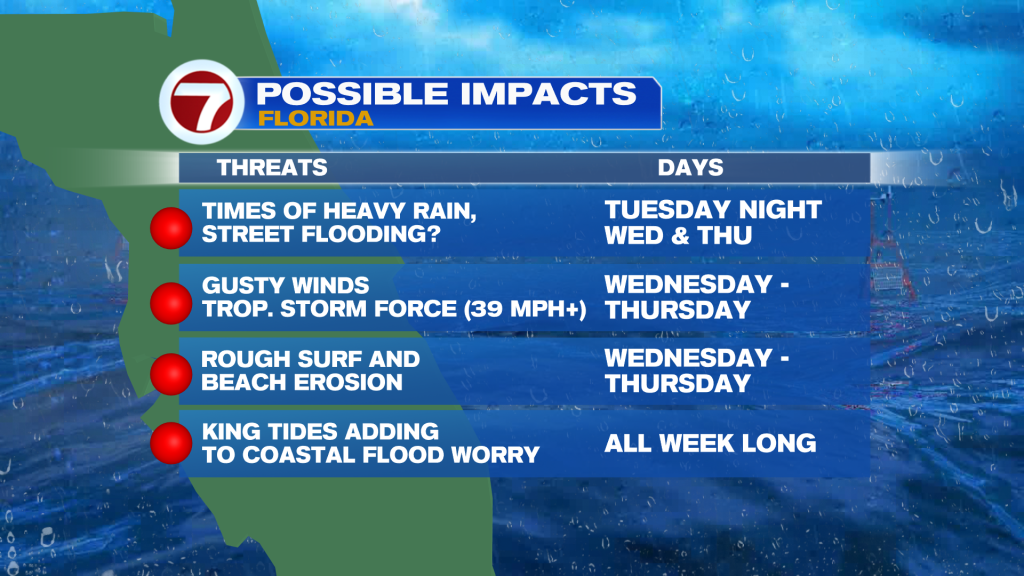
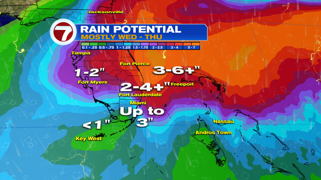
Just how much rain? It depends on the track and evolution of Nicole. For now, coastal communities could see up to 3 inches or more of rain and then on top of that the King Tides present this week adding to the coastal flood worry.
Stay tuned to your Storm Station, 7News!
Vivian Gonzalez
Meteorologist, AMS Certified
WSVN Channel 7
Copyright 2024 Sunbeam Television Corp. All rights reserved. This material may not be published, broadcast, rewritten or redistributed.