The Tropics are bubbling up.
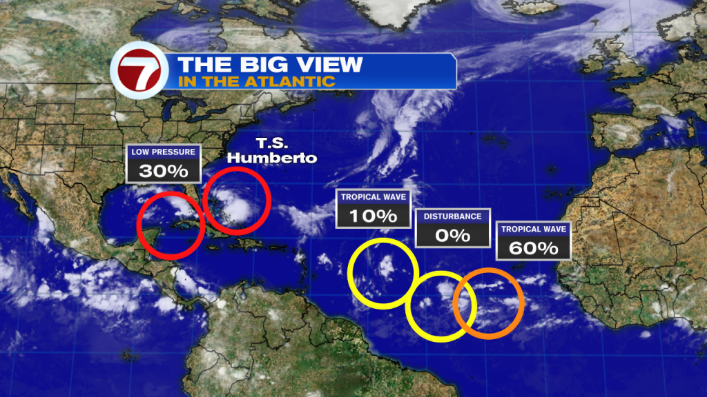
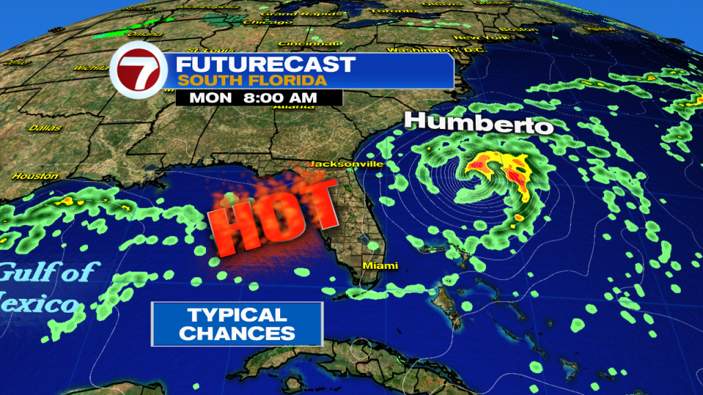
The Northwest Bahamas is now dealing with Tropical Storm Humberto as it moves slowly towards the NW. Latest forecast track keeps Humberto away from the state of Florida with no threat to land anywhere in the Southeastern United States. Humberto is forecast to strengthen into hurricane status by the start of the work week as it makes a turn towards the East into the Atlantic. Interests in Bermuda should monitor the progress of Humberto.
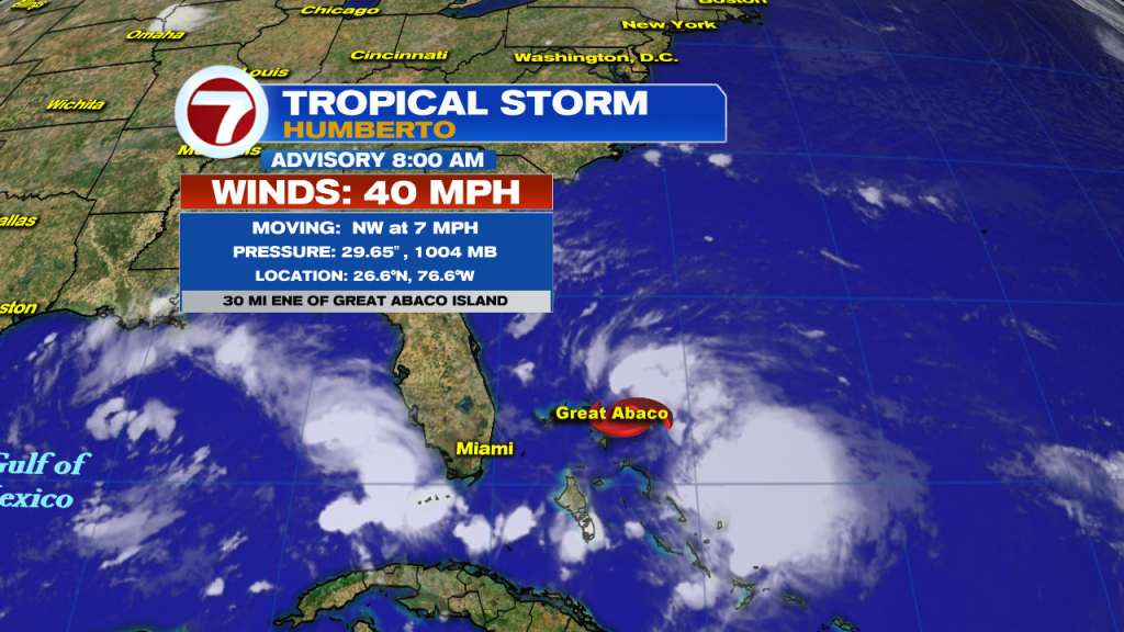

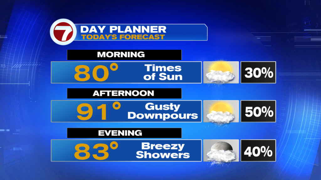
South Florida will continue to feel indirect impacts from Tropical Storm Humberto. Strong Northeast winds will continue to tap into moisture from Humberto, bringing gusty tropical downpours across South Florida at any given time. In between the wet times, South Florida will also enjoy times of sunshine with a nice breeze, especially along coastal areas. Those gusty to windy conditions will also leave a High Rip Current Risk across East Coast Beaches. And while it will be warm enough, boating conditions will remain dangerous as winds from Humberto have kicked up seas along nearshore and offshore waters.

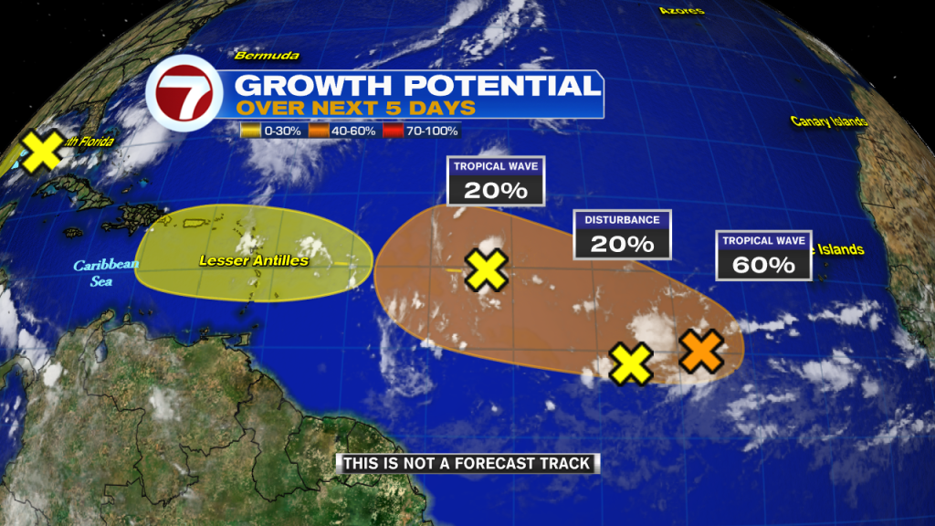
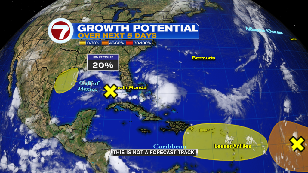
Elsewhere in the Tropics…we are now keeping an eye on FOUR OTHER AREAS with a chance for development into tropical systems over the Gulf of Mexico and Atlantic waters combined. Out of the 4 areas, one area in particular is close to home. A low pressure system in the Eastern Gulf of Mexico is producing showers and thunderstorms across the Lower Keys since late Friday night. This area has a chance for development once it reaches the Western Gulf of Mexico. We’ll have to keep a close eye on the 3 remaining areas in the Atlantic as one of them could become a tropical depression as early as next week.
Sunday in South Florida shows a slow transition to a more typical weather pattern. As Humberto moves farther North, winds in South Florida will shift out of the west. This will keep the focus for rain and thunderstorm activity over the East Coast of Florida during the afternoon hours. Temperatures will also soar into the mid 90s across some spots.

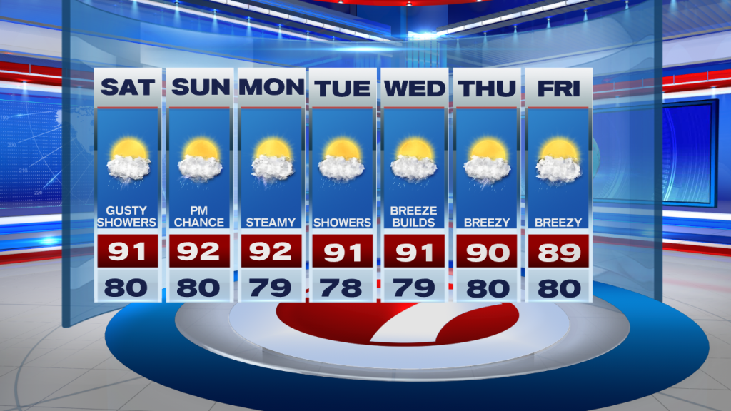
And just when the weather pattern in South Florida goes back to “normal by the middle of next week, the breeze will begin to pick up once again. Breezy conditions return by the end of next work week.
Hope everyone has a wonderful weekend!
Erika Delgado
Meteorologist
WSVN Channel 7 News
Copyright 2024 Sunbeam Television Corp. All rights reserved. This material may not be published, broadcast, rewritten or redistributed.