We are in store for a hot Saturday. High pressure will be our main weather maker to kick off this Father’s Day weekend.
With less cloud cover expected than recent days, daytime highs are forecast to rise into the low 90s. When you factor in the humidity, the inland heat will feel like 100° to 105° by the afternoon hours.

The sea breeze will also fire up by the afternoon. This will push isolated showers and storms inland through the evening hours. While rain coverage is not expected to be as high as recent days, the few storms that do develop have the potential to be strong.
As we slide into the latter half of the weekend, a fizzling front to the north of us will bring a surge of moisture in our directions. Therefore, scattered showers and spotty storms will return to our forecast for Sunday and stick around to start the work week.

The rest of the week ahead will bring us a summer-like pattern of morning coastal and metro showers with inland afternoon through evening storms.
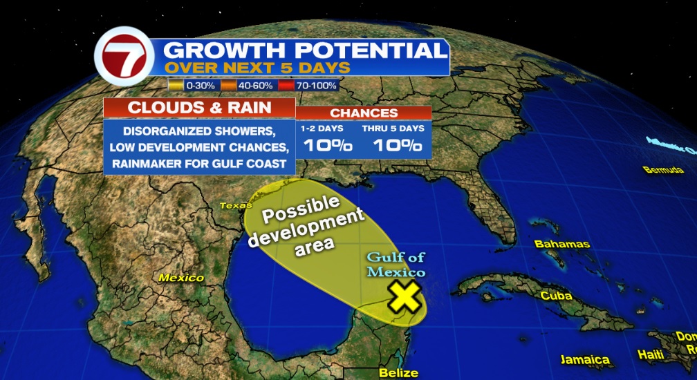
TROPICS
Area of disturbed weather looks to bring Texas and SW Louisiana showers and storms as it drifts northwest over the Gulf waters. Minimal tropical development chances.
Copyright 2024 Sunbeam Television Corp. All rights reserved. This material may not be published, broadcast, rewritten or redistributed.