Happy Thursday, South Florida!
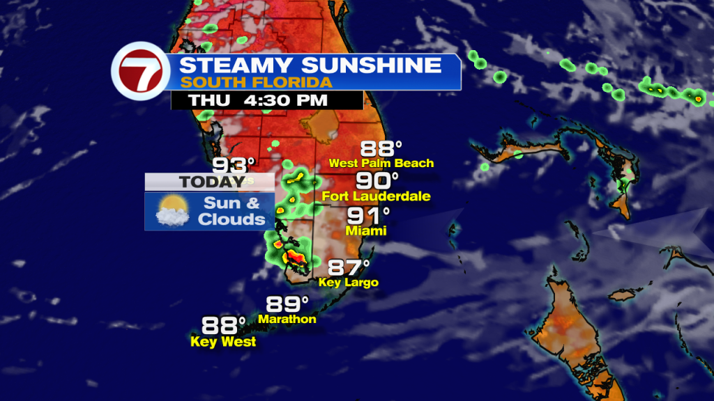
Hopefully everyone has had a great week so far. Today is ‘Friday Eve’ and the weather pattern has been rather quiet through much of the week (as far as rain is concerned). This morning was no different. South Florida woke up to mainly dry conditions, warm temperatures in the upper 70s and lower 80s and with a light onshore wind out of the East. The reason? A large area of high pressure in the Gulf of Mexico and dry air in the mid levels of the atmosphere have helped our weather remain in check.

Today will be similar to the last few days across South Florida. We can expect a few spotty to isolated showers through the first half of the day but with a wind off the water, any showers that do develop will push towards the Gulf Coast in the afternoon. Our afternoon high temperatures will once again reach into the lower 90s but once you factor in the humidity, temperatures will be feeling like the 100s across all of South Florida. So please remember to keep hydrated and if spending significant time outdoors, be sure to give yourself a break from the heat from time to time.
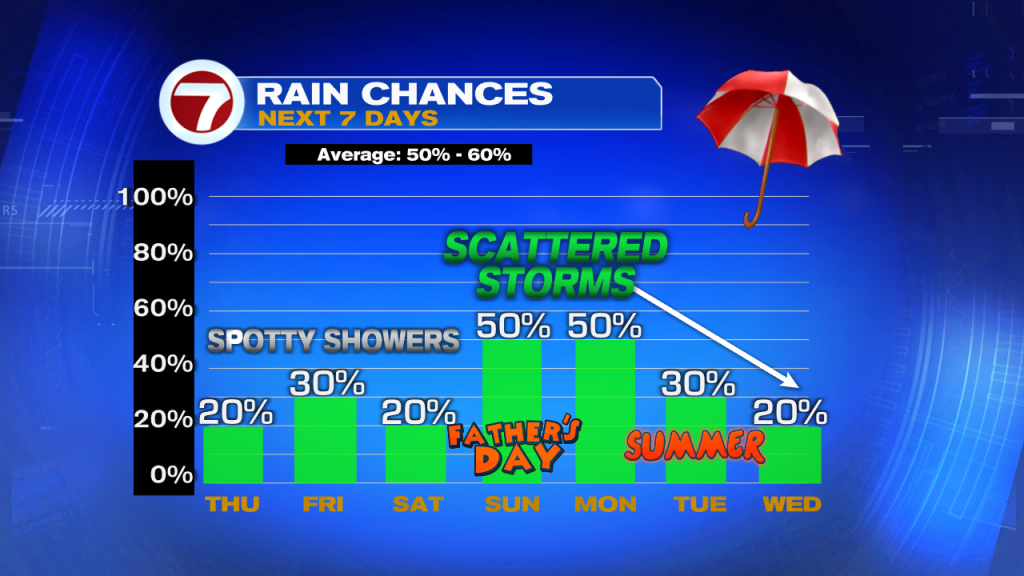
Looking ahead, drier days continue through at least the end of the work week as Saharan dust remains nearby for one more day and while high pressure and dry air remain in place. This means our wind pattern out of the East to Southeast will continue to push showers inland and out west towards the Gulf Coast of Florida. As we fast forward into the upcoming weekend, a weak front will enter Northern Florida, which will cause our wind pattern to veer out of the South to Southwest. This will help trap moisture across our area once again. This means that any thunderstorms that do develop will push towards the East coast in the afternoon on Father’s Day.
Have a great day!
Erika Delgado
Meteorologist
WSVN Channel 7 News
Copyright 2024 Sunbeam Television Corp. All rights reserved. This material may not be published, broadcast, rewritten or redistributed.