Happy First Saturday of Fall, South Florida!
Hopefully everyone had a great week despite the thunderstorms we saw almost every afternoon. Fall officially began on Wednesday but we wouldn’t know it here in South Florida because temperatures continue to reach into the upper 80s and lower 90s with afternoon thunderstorms becoming a daily event across our area. But there are some changes headed our way and those changes involve a front.

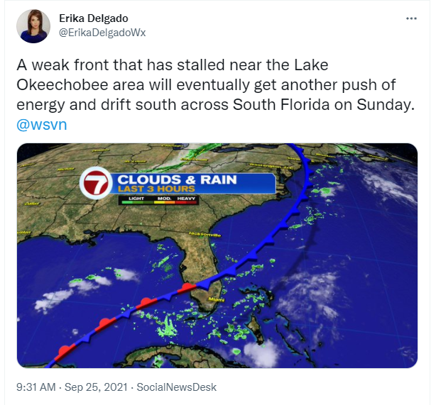
A front that is currently stalled out across the Lake Okeechobee region is forecast to move across South Florida on Sunday and promises to bring some changes to the forecast. Now let’s not confuse this front with one that we’re used to seeing in January and February. This is a very weak ‘Fall front’ that will make temperatures and conditions in South Florida a bit more bearable. But before the benefits of this front actually reach us, we will still have to deal with some unsettled weather first.
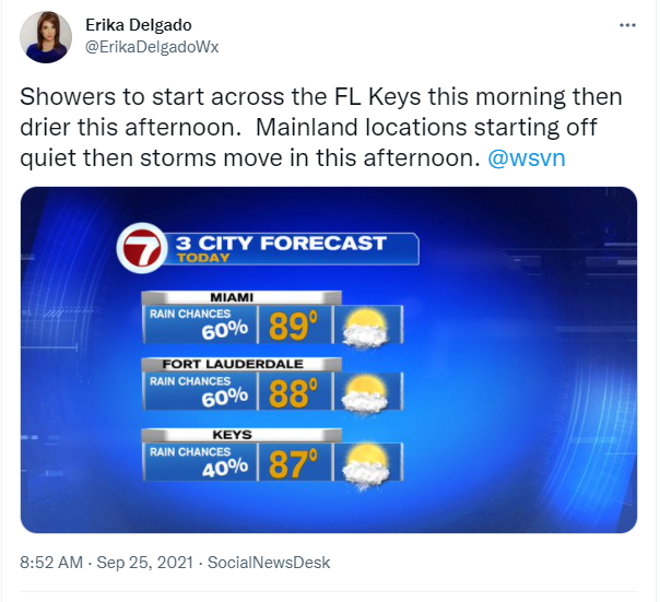
After a mild & muggy start to our day, South Florida can expect another round of scattered afternoon thunderstorms across our area. Temperatures will reach into the upper 80s and humidity levels will still remain high throughout the day today. This will make temperatures feel like the 90s. So if you have any outdoor plans throughout the day today, be sure to keep the umbrella close by just in case you see showers and thunderstorms popping in your area. In the meantime, take advantage of the dry time we are expecting through the morning.
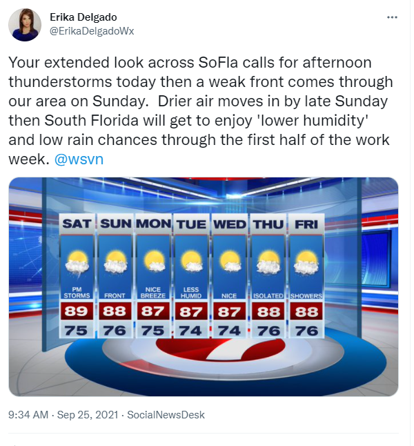
The front comes through our area on Sunday but will take its time to clear South Florida. With the front still close by, and with an onshore flow out of the Northeast, showers will be possible early in the day Sunday. Then drier air will begin to move into South Florida later in the day. Temperatures will still remain warm in the mid to upper 80s across South Florida. And then the changes finally reach us as we head into next week.

Speaking of next week, the front is forecast to have cleared all of South Florida by Monday bringing lower humidity behind it. As the drier air begins to move in, South Florida will feel somewhat of a difference. The difference won’t be so much as far as our temperatures are concerned (although mid to upper 80s does sound better than mid to lower 90s) but the change will be more felt as far as humidity levels are concerned. To be quite honest, a front this time of year doesn’t usually clear South Florida so we should definitely feel lucky that we’re even getting some of this nice weather. And this nice weather looks to stick around through at least the first half of the work week before showers slowly return to the forecast by the end of the week.
Have a great afternoon!
Erika Delgado
Meteorologist
WSVN Channel 7 News
Copyright 2024 Sunbeam Television Corp. All rights reserved. This material may not be published, broadcast, rewritten or redistributed.