

This weekend starts off where we left off during the work week. Lots of sun, with isolated showers and storms especially inland.
Taking a closer look at the rain chances this weekend, it’s the status-quo for us this summer. Easterly flow will dominate this weekend which means two things. There will be a chance of showers with the Atlantic sea breeze along the coast in the morning and then the best chances will shift inland in the afternoon and evening towards the Florida west coast. Coverage both days looks low-ish – around 20 – 30% for Saturday and Sunday.
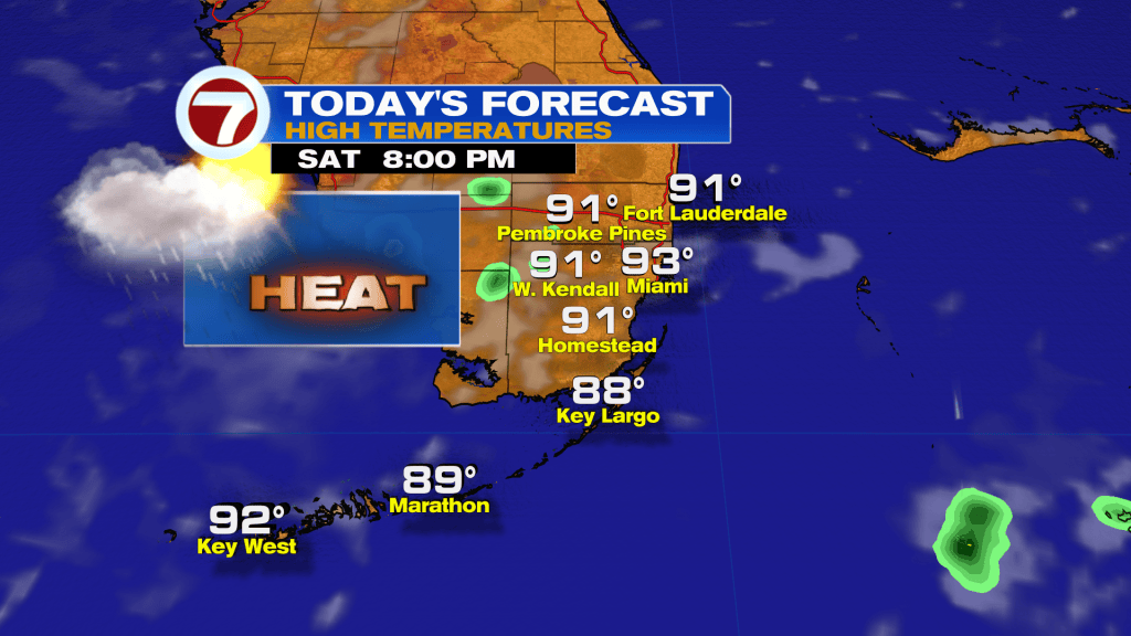
Temperatures look quite hot during the day, with high temperatures in the lower 90s. The heat index will climb into the 100-105 degree range thanks to that steamy sun, so make sure you drink lots of water and stay cool in the air conditioning!
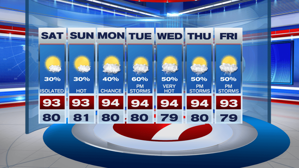
Looking ahead, we’ll see a pattern change across South Florida next week. We will return to a westerly wind regime across the sunshine state, which will usher in higher rain chances for us on the Atlantic side of the Peninsula. Each day will feature a hot and dry start, with temperatures soaring into the mid-90s, and the heat index in the triples. By the afternoon, the Gulf sea breeze arrives on our side of the state sparking scattered storms. Right now its looking like 50-60% coverage each afternoon.
TROPICAL UPDATE
All eyes are on Hurricane Erin, which has been putting on a show north of the Leeward Islands. Erin became the first major hurricane of the 2025 Atlantic Hurricane Season this morning. The first major hurricane typically forms on September 1st, so we’re about two weeks ahead of schedule compared to schedule.
As of the 8AM advisory, Erin is a an extremely dangerous Category 4 hurricane with 145 MPH winds. Erin is quickly moving to the west-northwest at 20 MPH and is passing north of the Virgin Islands this morning.
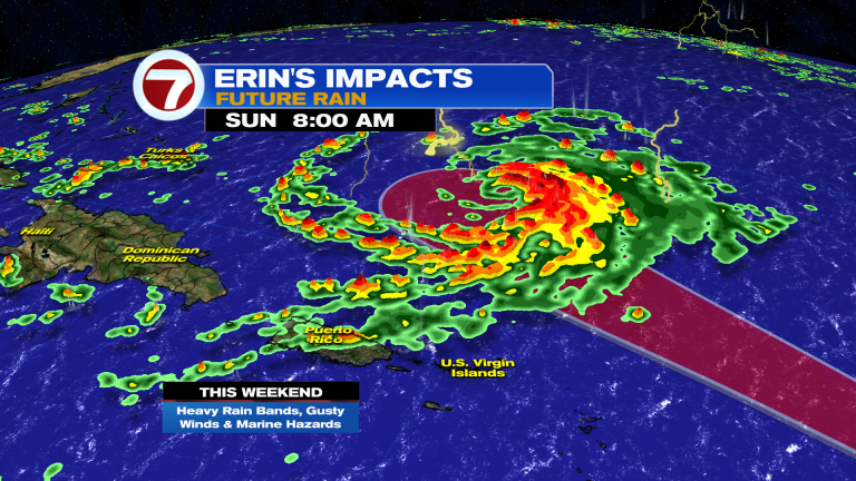
The core of the storm is expected to stay north of the Caribbean Islands, but will bring squally conditions to the Virgin Islands, Puerto Rico, and Hispaniola this weekend. Rough seas and rip currents will also be an issue for the islands.
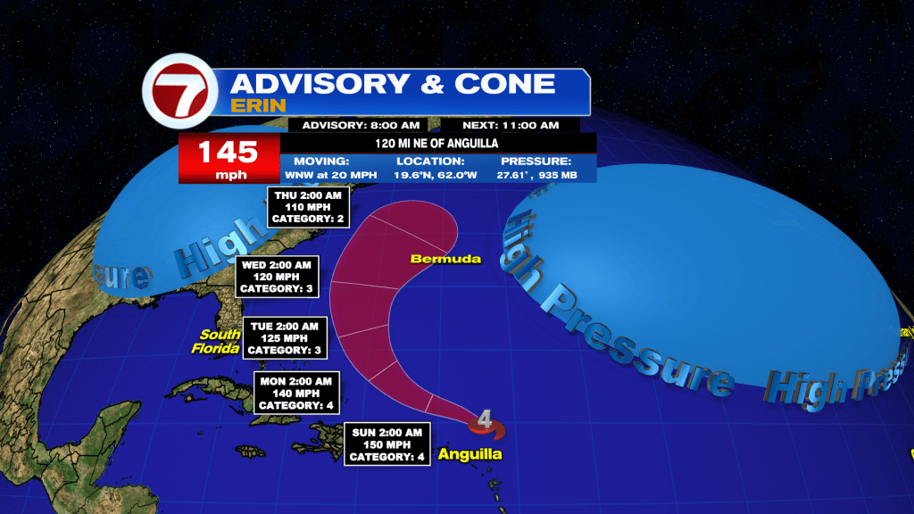
Erin is expected to remain a large and powerful hurricane as it passes north of the islands this weekend. By early next week, Erin is will turn north into a weakness in the Bermuda high, which will steer it away from the United States. However, rough seas and rip currents will be a big story along the US East Coast next week. Meanwhile, interests in Bermuda will have to keep a close eye on Erin heading into next week.