Happy Sunday, South Florida!
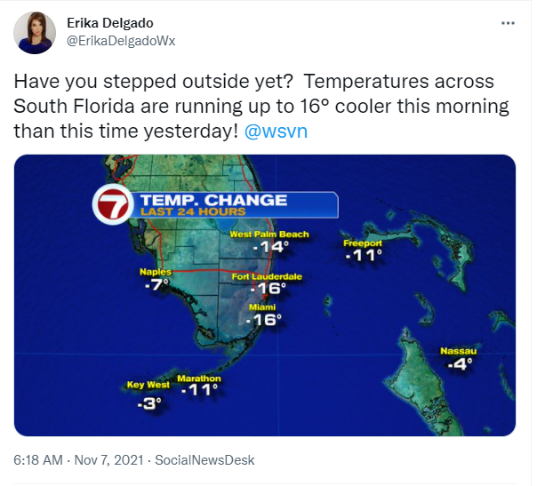
Hopefully everyone has had a nice start to the weekend so far. After Friday’s rain event, things could only get better from there! Am I right? After a front came through our area on Saturday morning, conditions only continued to improve here in South Florida and we finally felt like there was a [chilly] change in the air. And this morning we surely felt that change as many South Florida locations woke up in the 50s coupled with lower humidity.
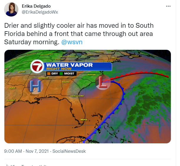
Behind Saturday’s Front, the wind direction here in South Florida has veered out of the Northwest and that is helping to usher in drier and slightly cooler air across our area. Now that the moisture and humidity have been replaced by much drier and cooler air, conditions will finally begin to FEEL like November in South Florida. High-pressure will be settling in and that’s going to help keep the wind direction mainly out of the North through at least the next day or two.
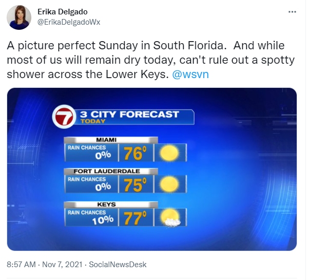
Today promises to be a picture perfect day in South Florida. After starting off with temperatures in the 50s and 60s, our afternoon high temperatures will be reaching into the mid upper 70s. Wind speeds won’t be as strong as they were yesterday but they could be breezy at times, which will make it feel cool if you find yourself outside in the shade. The lower humidity is the most noticeable thing we will feel today as our humidity levels have been very high through the last few days. Of course it goes without saying that rain chances across South Florida will remain on the low end. A spotty shower can’t be ruled out across the Lower Keys as Northwest winds could tap into moisture from the Gulf of Mexico.
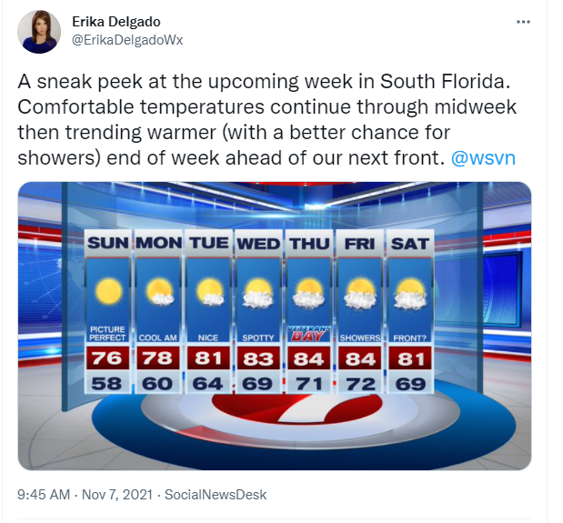
Looking ahead, it seems that these nice fall-like conditions will stick around as we head into the start of the work week. And we can thank a high pressure system for all of that. Monday morning will be another cool one with temperatures across many spots in the 50s and then high temperatures struggling to reach the upper 70s once again. The low humidity will also stick around through at least the first half of the work week while we continue to enjoy very comfortable temperatures each afternoon. By the end of the week the air mass begins to moderate a bit as we with the return of an easterly ocean breeze. That should help drive humidity levels a little higher than what we’re seeing right now and with the approach of another front, we may even see a few showers return to the forecast by the end of the week. In the meantime enjoy these nice conditions.
Have a great week!
Erika Delgado – Meteorologist
WSVN Channel 7 News
Copyright 2024 Sunbeam Television Corp. All rights reserved. This material may not be published, broadcast, rewritten or redistributed.