Happy Saturday, South Florida!
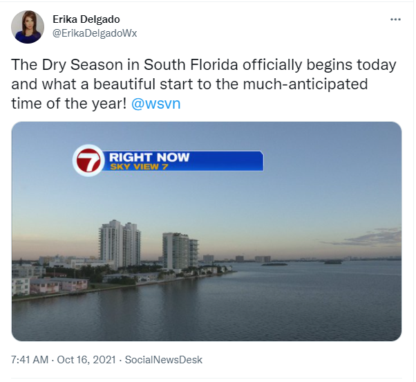
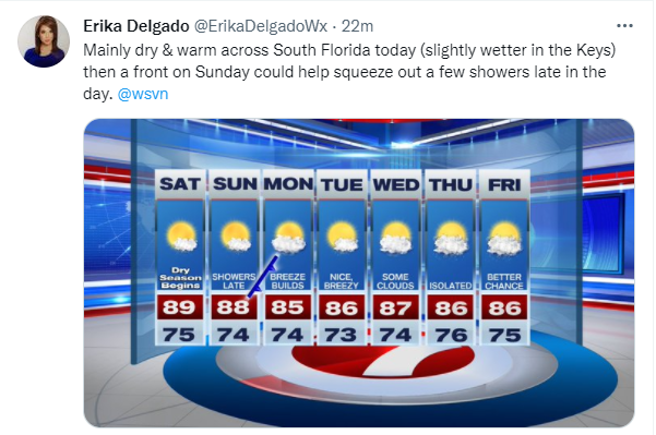
Hopefully everyone had a great week. Today marks the first day of the dry season in South Florida and it seems fitting given the weather conditions we are expecting through the start of the weekend. We have been stuck in a pattern the last few days with scattered showers coming in along with the breeze but today things should change a bit for South Florida. Early this morning we woke up to a few showers surrounding our area but they were mostly offshore. Otherwise we woke up today to mild temperatures once again.
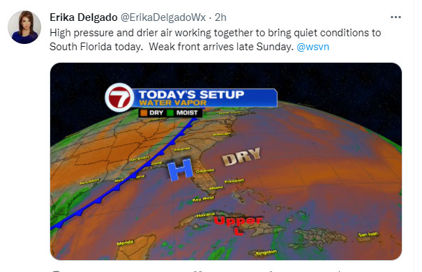
Several weather features around South Florida will continue to dominate our weather pattern. The upper-level low pressure system that has been producing showers near the Bahamas (and thus being pushed towards South Florida in the last few days) continues to fizzle and move farther southeast. Meanwell a building high-pressure system will move into our area. Those two features, together with drier air in the mid and upper levels of the atmosphere, should leave lower rain chances throughout the day today. But we will also be eyeing our next front that should be entering the Florida peninsula later today.
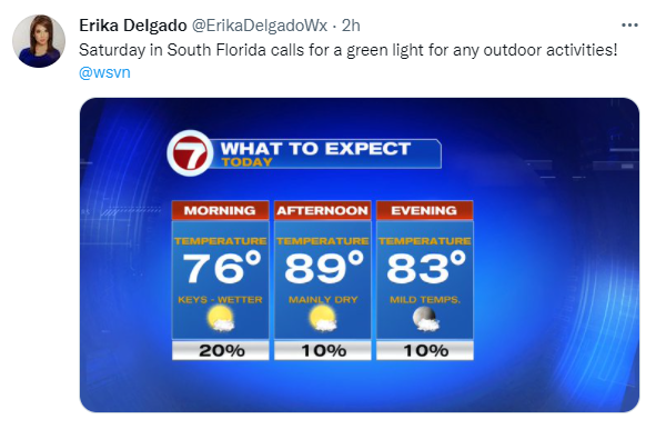
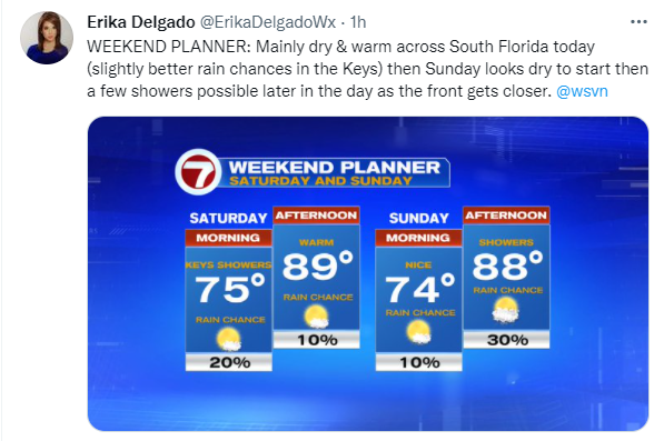
Speaking of today, we can expect slightly lower rain chances than what we ended up seeing on Friday. Our wind pattern should be a bit more out of the North and that should help keep a lot of the shower activity mostly offshore. This doesn’t mean we are expecting a completely dry day. But models are suggesting that it won’t be as ‘showery’ as it was on Friday. Our afternoon high temperatures will remain a few degrees above average in the upper 80s.
The latter part of the weekend does bring some changes. The above mentioned front will finally reach South Florida at some point late in the day Sunday, if not Sunday night. There will be limited moisture associated with this front, especially because the front should begin to dissipate as it reaches our area. But, given that we live in South Florida, there could still be sufficient moisture to help squeeze out a few showers as the front gets closer on Sunday. So even though we’re not expecting a washout of a day, we have bumped up rain chances slightly for the latter part of the weekend,…mainly later in the day.
All week, weather models were unclear whether or not this front would stall over our area or if it would actually clear South Florida. But models are suggesting now that the front may actually clear us and stall somewhere over the Florida Straits. This should help keep rain chances on the lower end of the scale as we start the work week. However, heading into the work week, we are expecting the breeze to build since we will have 1) a dying front to the south of us and 2) a building high-pressure system to the North of us. And given that we will have a strong wind off the water (a Northeast breeze), isolated showers cannot be ruled out. The second half of the week remains uncertain as models are suggesting that the front may begin to lift back north across our area and if it does, then we could be looking at a few wetter days here in South Florida by the end of the work week. In the meantime enjoy this beautiful weekend we are expecting. And welcome to the dry season in South Florida!
Have a great weekend!
Erika Delgado
Meteorologist
WSVN Channel 7 News
Copyright 2024 Sunbeam Television Corp. All rights reserved. This material may not be published, broadcast, rewritten or redistributed.