As a strong cold front closes in on South Florida for the first half of the weekend, expect to see our sunny morning skies met with storm clouds and scattered showers by the afternoon hours on Saturday.

With the heating of the day, we could also see spotty thunderstorms favoring the afternoon/early evening hours.
As the front starts to clear the area on Saturday night, stray showers will linger under mostly cloudy skies. But, a gradual clearing will begin during the overnight hours.
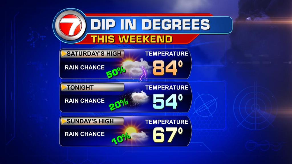
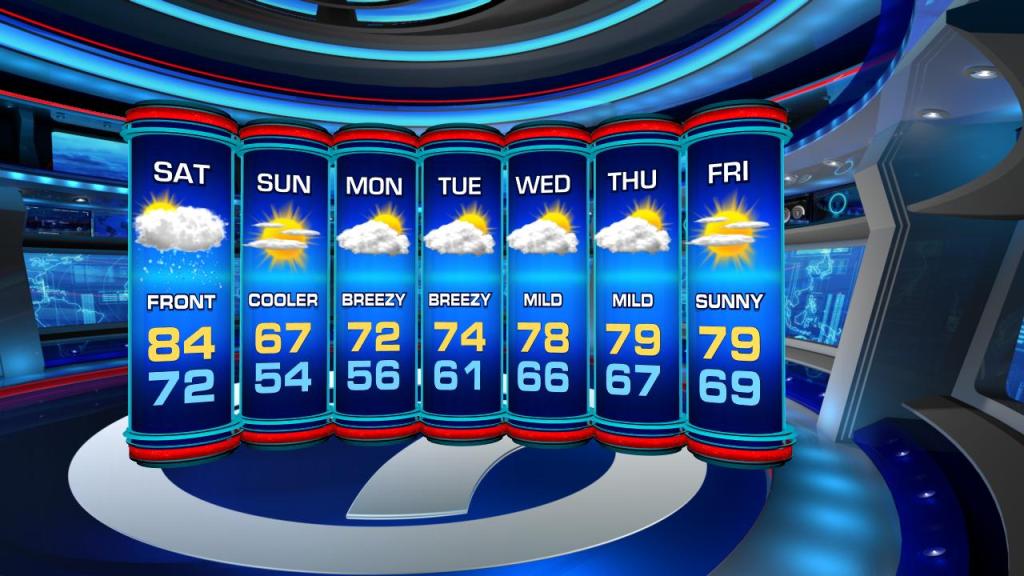
Cooler temps will roll in by Sunday morning as the 50s make a comeback. Daytime highs will be below seasonal in the upper 60s.
Additionally, high winds from the north will move in shifting from 20 mph to 30 mph through Monday. These speedy winds will rough up the surf & seas prompting beach/boating advisories from Saturday evening through Sunday.
Copyright 2024 Sunbeam Television Corp. All rights reserved. This material may not be published, broadcast, rewritten or redistributed.