Can we say good-bye to the heat already? It’s December for crying out loud! Key West on Tuesday tied a record that had been in the books since the 19th century. Yes, the 19th century.

We are hoping a cold front just South of Lake Okeechobee will bring us some relief.

The leading edge of the front will continue to move south and enter the Florida Straits by Wednesday morning. We may still see an isolated shower with the passage of the front.
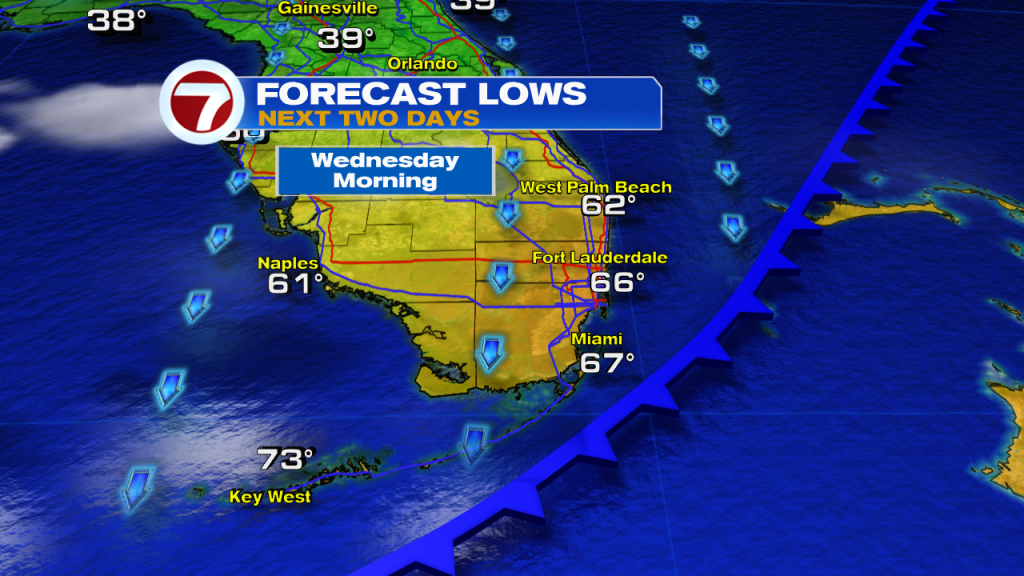
Once the front moves offshore, the temps will slowly start to come down. We are expecting wake up temps on Wednesday, to be in the 60s, with the Lower Keys hanging on to the 70s. It will turn breezy after the front, with mild afternoon sunshine. Highs will be in the mid to upper 70s with little humidity. A big change from the past few days.
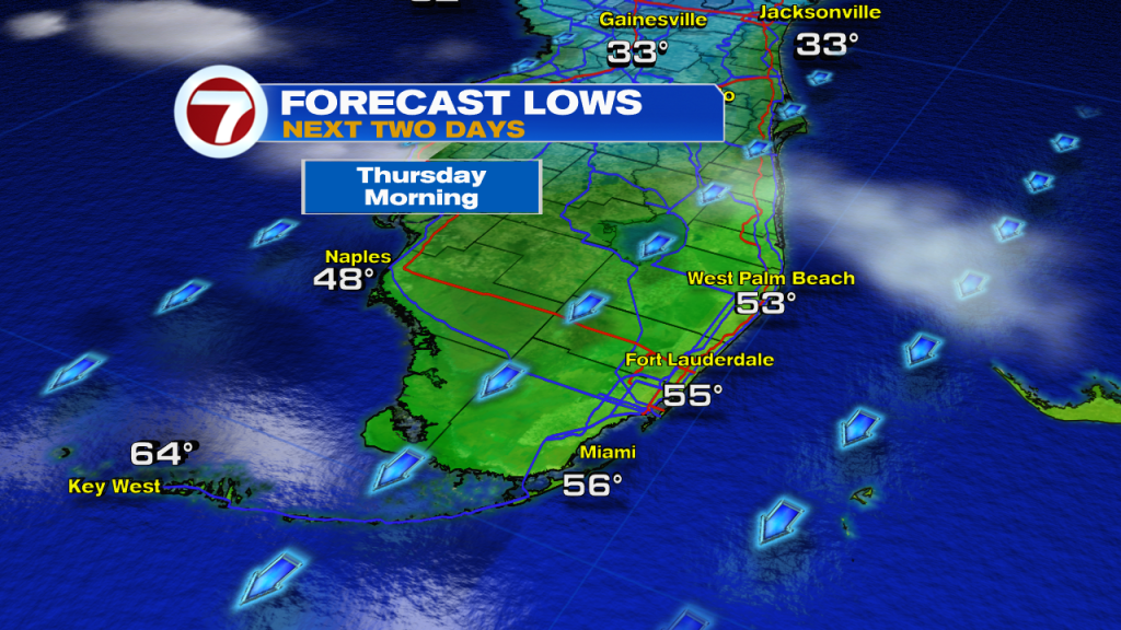
On Thursday morning, the colder air settles in and we can expect lows dipping into the mid 50s. Some areas may see low 50s, with Southwest Florida dipping into the upper 40s. The Keys will also get a break from the heat with lows in the 60s. Expect Thursday afternoon to have mostly sunny skies with a north/northeasterly breeze.

Wednesday’s lows will be very chilly across Northern Florida.
The forecasts are calling for temps in the upper 30s. Some areas could drop into the low to mid 30s.
That will be very cold for that part of the state.
 A Freeze Watch is already in place for North Florida due to the expected chilly temps that will stick around through Thursday morning at least.