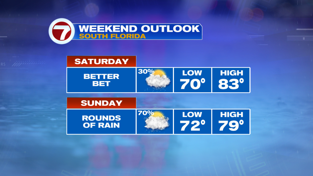
The generally cloudy skies stick around with us this weekend and eventually those clouds will produce rain looking ahead to tonight and Sunday. Until then, Saturday overall will be a nice, comfortable day. Sure it will be mostly cloudy with sunny breaks at times, but humidity will remain at a comfy level paired with temperatures near average in the upper 70s to low 80s.
There is a stalled front and non-tropical area of low pressure to our south and over the Gulf of Mexico, respectively, which will begin to spawn showers this evening. Showers will begin isolated across the Keys late today, then that activity will overspread to the north as the overnight hours progress into mainland South Florida. This will make for a rather raw overnight with temperatures into the low to mid 70s.
Do your outdoor plans Saturday because Sunday will be a rainy and soggy day. It won’t be rainy the entire day but expect rounds of rain with mostly cloudy skies at times. Given all of the moisture surging in, there is the potential for heavy rain and perhaps isolated flooding. Otherwise it won’t be as warm with temperatures slightly below average into the upper 70s.
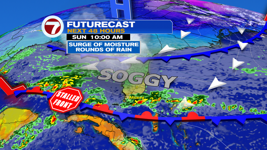
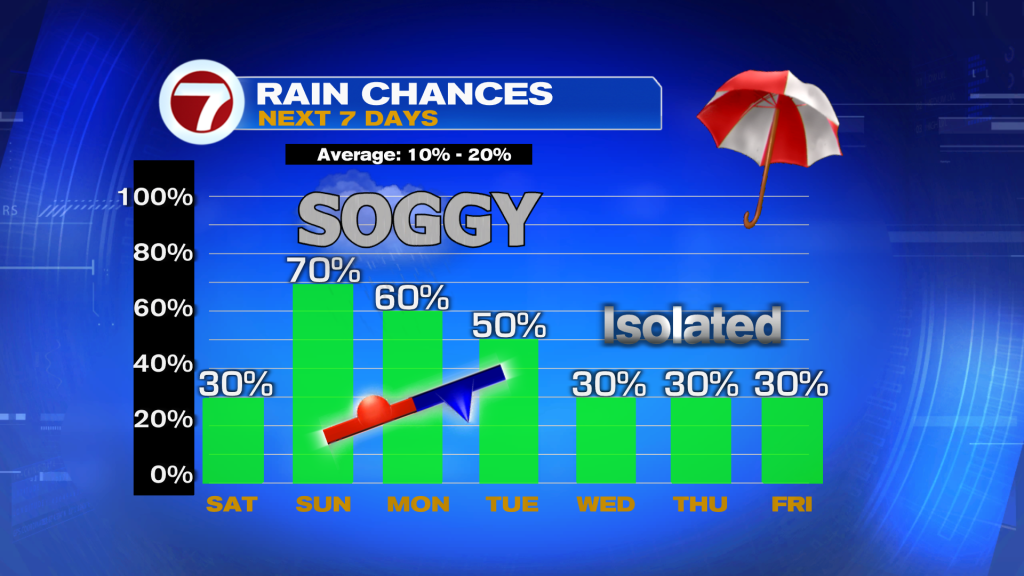
Unfortunately this rain is not a “one and done” deal because the showers stick around through at least the first half of the weekend. I do think Sunday is the wettest day but Monday and Tuesday will still feature a 50-60% rain chance due to the stalled front remaining near or south of South Florida.
During the second half of the weekend, we begin to see some changes to our weather pattern with that stalled front beginning to fall apart. Thursday and Friday will be warmer into the mid 80s but rain chances will be at a 30% chance so showers are expected to be more isolated. Therefore, conditions as of now for Thanksgiving are looking fairly nice besides a passing shower or two.