

Happy Mother’s Day to all moms out there! Unfortunately, we won’t get to enjoy the sunshine and bright, blue skies today but the day overall won’t be too bad. An upper level disturbance to our south and headed toward the Bahamas and swirling in more mid to upper levels clouds over South Florida this Sunday, making for mostly cloudy conditions. Most areas are looking to be dry today, at least, with only a 30% chance for rain. The best chance for seeing isolated showers and storms will be through midday today, then this activity should shift farther inland during the afternoon and evening hours. Highs will be near normal into the mid to upper 80s.
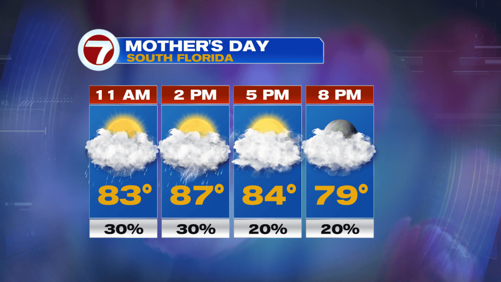
On Monday, rain chances look to be slightly higher with scattered showers and thunderstorms expected, again especially during the morning and midday hours — very fitting for the start of rainy season in South Florida. Highs will remain in the mid to upper 80s with more clouds around due to that upper disturbance over the Bahamas.
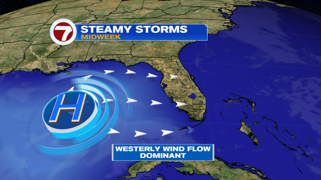
Now for the remainder of our new week, a more westerly wind flow is expected to develop by Wednesday, leading to hotter temperatures and a better chance for some afternoon showers and thunderstorms. Rain chances look to be at a 30-40% chance at this time with still plenty of dry time expected.
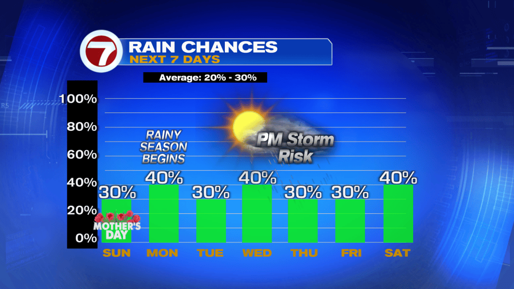
From Wednesday through at least Saturday, high temperatures are also forecast to be in the low 90s at many locations due to that land breeze.
