Happy Wednesday, South Florida!
The last few days have been picture perfect (and not what we are used to seeing during the month of April) thanks to last week’s cold front that brought us a refreshing change. And the beautiful weather conditions have continued through the start of the work week so far!

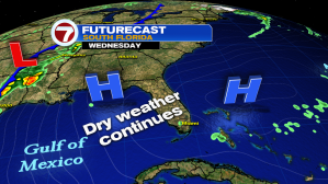

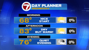
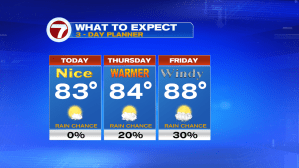
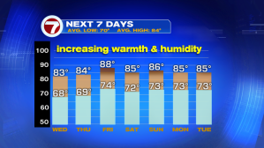
Although high pressure is starting to break down and push East, it still remains in control of the weather pattern. The much drier air mass that reinforced the quiet pattern has pushed farther into the Atlantic as moisture slowly starts to creep in. Although afternoon high temperatures will remain near-seasonal today, it is expected to be a touch warmer than the last few days. This means the warming trend we have been waiting for is finally here.


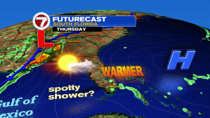
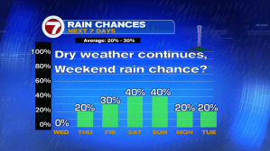
As High Pressure moves farther into the Atlantic, the wind direction will be veering out of the Southeast by Thursday (and out of the SSW on Friday), causing temperatures to soar well into the mid to upper 80s by the end of the week. So another dry day is expected for all of South Florida before the pattern swap brings HEAT, HUMIDITY & RAIN to the forecast.
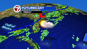
Speaking of the end of the week, it looks like another front (likely to develop over the Gulf of Mexico) approaches South Florida as we round the corner into the weekend. This will help bring showers & thunderstorms back in to the forecast as well. So before rain returns, let’s enjoy this beautiful Spring weather while we still can.
Have a great week!
Erika Delgado
Weekend Meteorologist
WSVN / Channel 7 News
Copyright 2024 Sunbeam Television Corp. All rights reserved. This material may not be published, broadcast, rewritten or redistributed.