We are still eyeing a weak low now near the northern coast of Central Cuba. The low is expected to move over the Florida Straits today and into the southeastern Gulf of Mexico by tomorrow. A Hurricane Hunters recon mission scheduled for Sunday afternoon to investigate this disorganized area of clouds and storms.
Still eyeing a weak low near Florida Straits. Recon mission scheduled for this afternoon @wsvn @7weather #flwx pic.twitter.com/AXR9cxyVPp
— Miss Chavis (@karlenechavis) August 28, 2016
Chances for development remain in the medium range through the next 5 days as it enters the warm waters of the Gulf.
Regardless of development, downpours and gusty winds are expected across Cuba through Sunday night. South Florida will also have a mix of heavy rain and gusty winds from Sunday through Wednesday.
Models are suggesting we could see up to 4″ of rainfall in spots thru Wednesday. Street flooding will be a concern from Sunday thru Wednesday with anytime downpours in the forecast.
Tropical moisture stirring up a soggy setup this weekend. Street flooding concerns thru WED #flwx @wsvn @7weather pic.twitter.com/3k4ZA7vMCo
— Miss Chavis (@karlenechavis) August 27, 2016
TROPICS
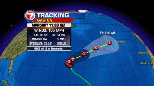
Tropical Depression 8 has formed over 400 miles to the southeast of North Carolina. A Tropical Storm Watch may be issued later today for the Outer Banks of North Carolina.
Models are suggesting this tropical depression could become a tropical storm on Monday. The forecast track also shows this storm skirting by the North Carolina shores on Tuesday.
TD 8 has formed to the east of North Carolina. Tropical Storm Watch may be issued later today @wsvn @7weather pic.twitter.com/M81p2dha16
— Miss Chavis (@karlenechavis) August 28, 2016

Copyright 2024 Sunbeam Television Corp. All rights reserved. This material may not be published, broadcast, rewritten or redistributed.
