After a stormy and unsettled week courtesy of Hurricane Ian, the pattern flipped for the best yesterday and this nicer stretch of weather will last into at least the start of the upcoming week in South Florida.
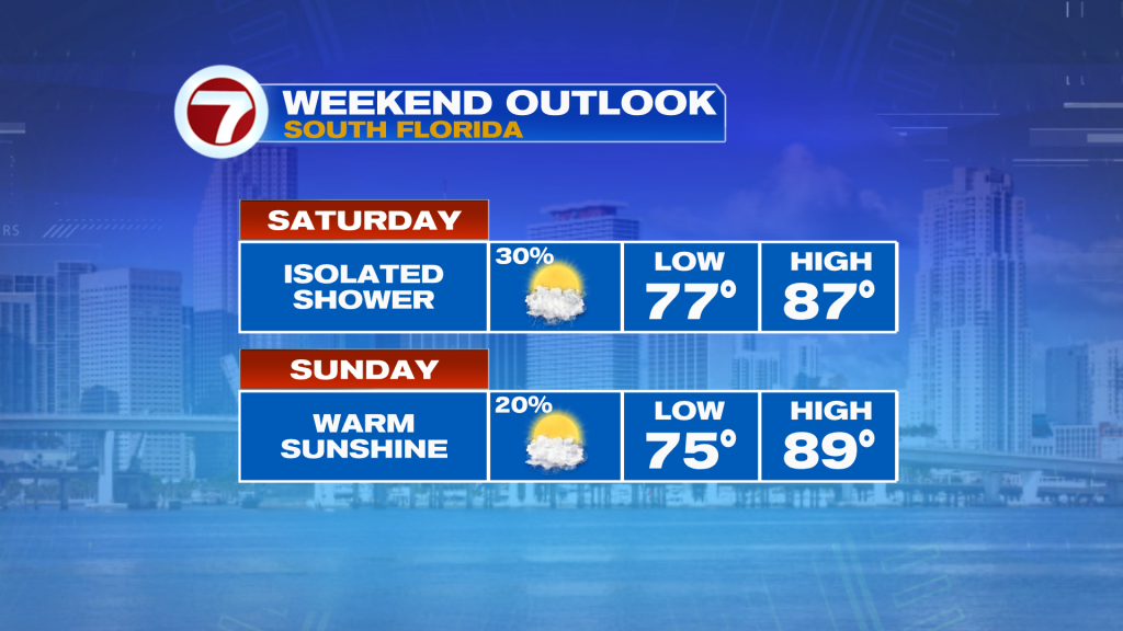
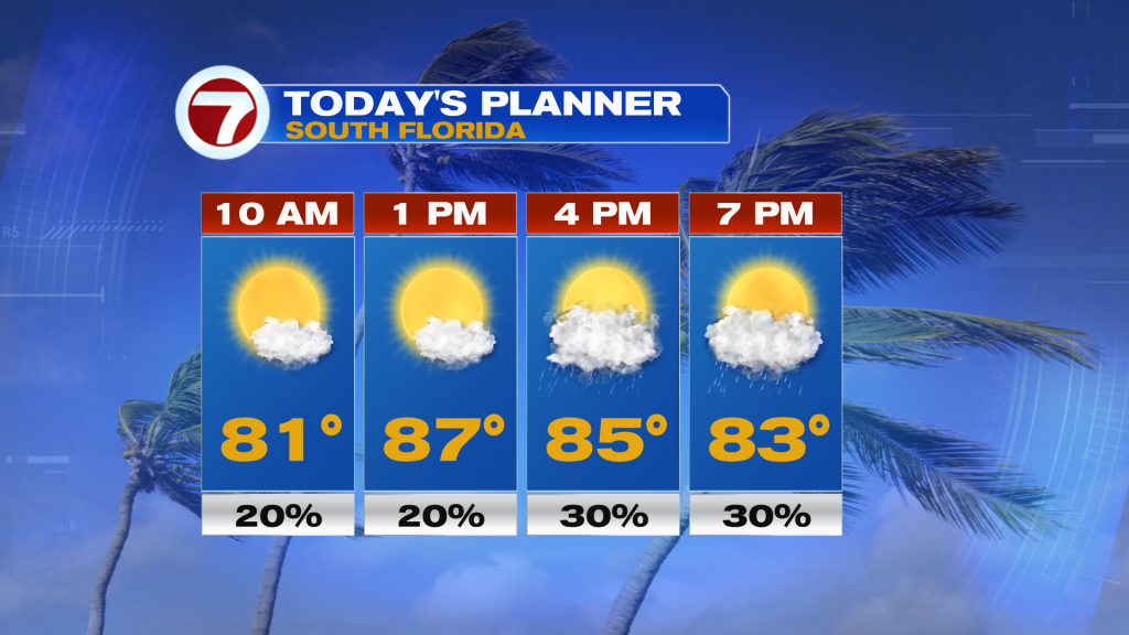
This Saturday, expect lots of sunshine to kick off the day with low temperatures in the mid to upper 70s. Temperatures in the afternoon will heat up into the mid to upper 80s — it will be warmer than yesterday. That warmth will come with a few clouds and the chance for an isolated shower late in the day. Rain chances will peak at 30%. A nicer feature that we experienced yesterday was a noticeable drop in humidity and that should also last through mid next week.
Tonight is looking dry with only a few passing clouds and low temperatures in the mid 70s thanks to a northwesterly wind.
Sunday is looking similar to Saturday with a good deal of sunshine and a low rain chance at 20% as an offshore disturbance over the Bahamas moves farther away. Now even though the weather will be nice this weekend, the rip current risk will remain high at the beaches but surf will not be as aggressive as it was on Friday.
The first few days of next week are looking nice with sunshine, highs in the upper 80s and low rain chances. By Thursday, isolated showers and storms return to the forecast as an easterly breeze regains control of our weather pattern. That should allow for humidity levels to bump back up again.
In the tropics, the final advisory on what was once Hurricane Ian was issued by the National Hurricane Center this morning. The remnant area of low pressure will continue to bring rain and gusty winds to parts of the mid-Atlantic and Appalachian Mountains this weekend, however.
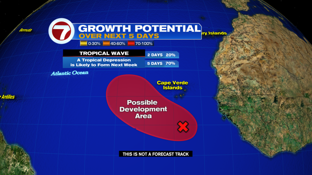
There is one area to watch in the Atlantic for potential tropical development. A tropical wave near the Cape Verde Islands has a high chance at becoming the season’s next tropical depression or storm next week but does not look to pose a threat to land at this time.