Heavy rain made a return to start the weekend. Under a stubborn swath of clouds, many areas saw between an inch and two inches of rain. While that may not sound impressive (during the peak of the rainy season) Flood Advisories were necessary due to previously saturated conditions. These included much of Broward County throughout the afternoon, on Saturday.

By sundown, the Miami skyline was improving. Only high clouds lingered into the early evening with a welcome break from the rain.

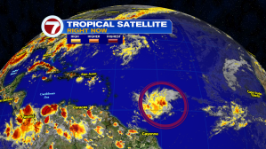
There are more signs of life in the tropics. Here’s newly-formed Tropical Storm Dorian in the Atlantic. It’s still several hundred miles from the Lesser Antilles. The Caribbean islands need to pay close attention to Dorian’s path in the days ahead.
This is the latest advisory on the tropical system. It’s a low-end storm, at this point, just barely over the 39 mph threshold to become a storm.

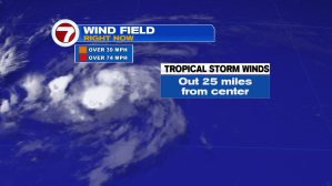
Dorian is also small and compact. Tropical storm force winds only extend out roughly 25 miles from its center. These small systems make it more tricky to predict intensity. Often, they can ramp quickly or suddenly weaken.
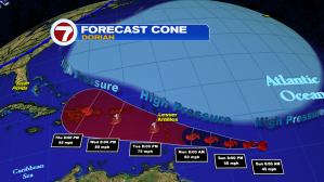
The official forecast track has Dorian tracking to the west-northwest over the next 5 days. It might be able to get a burst of strength near the Lesser Antilles. At this point in time, it is forecast to become a category 1 hurricane. Puerto Rico, the Dominican Republic, and Haiti will need to brace for potential impact from Dorian. Land interaction may weaken, or even tear-up the disturbance beyond that… but it’s impossible to know.
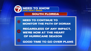
South Florida should be on-guard, just in case Dorian makes an approach (late in the week). While it’s too early to predict such a small system that’s still 2000 miles away, residents should monitor its progress from day to day. It’s an ideal time to at least refresh your plans, should a tropical system make an impact where you are.