Happy Tuesday, South Florida!
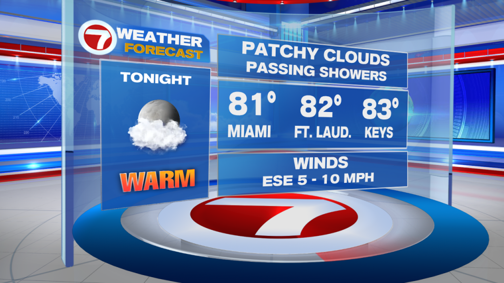
A warm ocean breeze this morning prevented temperatures from cooling any more than the mid to low 80s. It also allowed patchy clouds & a few spotty showers to push through coastal areas around sunrise. Despite the dry air in the mid and upper levels of the atmosphere, some of those showers even managed to reach inland areas of Broward County.
But the ocean breeze isn’t ALL bad. It has also been helping afternoon high temperatures remain close to where the should be – in the lower 90s. Of course, the moment anyone steps outside they would almost immediately disagree about the air temperature. The high humidity levels across South Florida have helped the actual air temperature FEEL warmer than it really is. So while our afternoon high temperatures have remained in the low 90s last few days, the FEELS LIKE temperature has been anywhere between 101-105 degrees! So it is advised to those spending any significant time outdoors to keep hydrated.


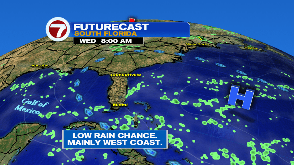
A mix of sun and clouds remains in the forecast today while the ocean breeze drags in an occasional shower through the early afternoon. From there, all shower and thunderstorm activity will shift its focus towards Interior sections. That means AWAY from East Coast metro areas. But beware! While it will be hot enough to get into the ocean for some relief from this heat, rip currents are still a big threat along those East Coast beaches. If you ever feel caught in a rip current, it is advised NOT to swim against it but rather to swim parallel to the coast until you don’t feel that grip anymore. At that point it is safe to swim back to shore.

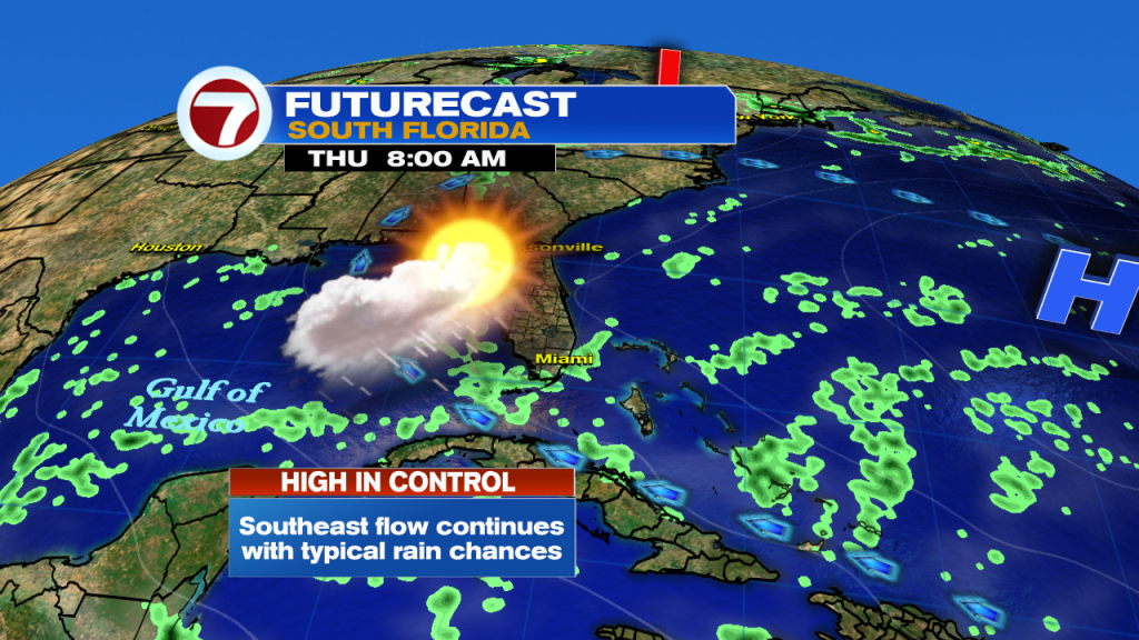
This pattern of morning coastal showers followed by inland afternoon thunderstorms is quite typical for this time of year (and looks to stick around through the rest of the work week and possibly lingering into the upcoming weekend). Not to mention, rain chances will remain normal or just below normal for this time of year. So be sure to take full advantage of this great weather while we still can because as we all know very well here in South Florida,….all good things come to an end. That’s right, showers are scheduled to return to the forecast for the start of next work week.

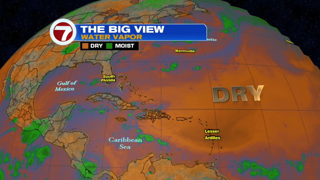
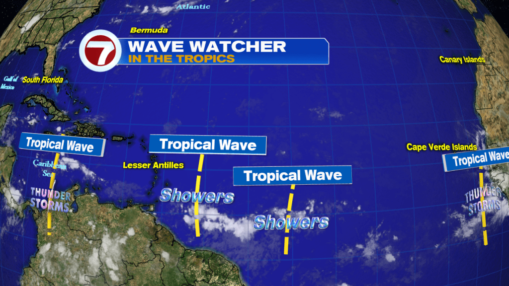
Shifting gears towards the tropics. Barry is once again a low pressure system over the Mississippi Valley still dumping heavy rain across the Mississippi & Ohio Valleys. Lots of dry air over the Atlantic has also helped keep the tropical waves in check So tropics should remain quiet for the next 2-5 days.
Have a great day!
Erika Delgado
Meteorologist
WSVN Channel 7 News
Copyright 2024 Sunbeam Television Corp. All rights reserved. This material may not be published, broadcast, rewritten or redistributed.