A summer-like pattern will remain in control with coastal showers and afternoon/evening storms favoring the inland areas this weekend.

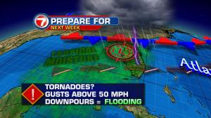
Sunday will be the transition day with scattered showers and storms. By the start of the work week, an influx of deep moisture from tropical feature is anticipated to develop into our next system in the Gulf of Mexico.
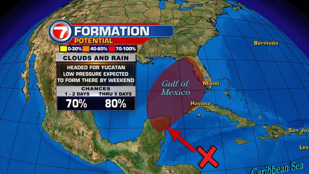
A widespread area of clouds and showers over the northwestern Caribbean Sea has high chances of development as it drifts over the Gulf of Mexico by Sunday.


Models are suggesting the low, once it develops, will cut across the Florida Panhandle.
Regardless of development, locally heavy rains and flooding will be possible over portions of the Yucatan Peninsula, western Cuba, the Florida Keys, and the Florida Peninsula during the next several days.
Strong to severe storms, flooding, wind gust above 50 mph, and isolated tornadoes cannot be rules out for South Florida early Monday through Tuesday.
Additionally, Bonnie is still churning in the open Atlantic waters. Located over 180 miles to the north of Bermuda, this system will remain a hazard for the shipping lanes as it tracks east. It is forecast to become a remnant low by Saturday night.
Copyright 2024 Sunbeam Television Corp. All rights reserved. This material may not be published, broadcast, rewritten or redistributed.