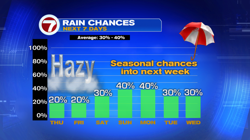
High pressure, our “fair weather” friend, will continue to dominate our weather pattern. This teamed up with the return of Saharan dust looks to keep our skies mostly dry and hazy through the end of the week.

With the developing sea breeze, expect isolated showers and storms to favor the inland areas by the afternoon and early evening hours.
As the drier air moves out by the weekend, tropical moisture is set to return. Expect scattered showers and thunderstorms across South Florida. The bulk of the moisture will be inland by the afternoon and early evening hours. More of our typical summertime pattern.
TROPICS
And now there’s Ernesto. The National Hurricane Center started issuing advisories on this Subtropical system Wednesday morning.
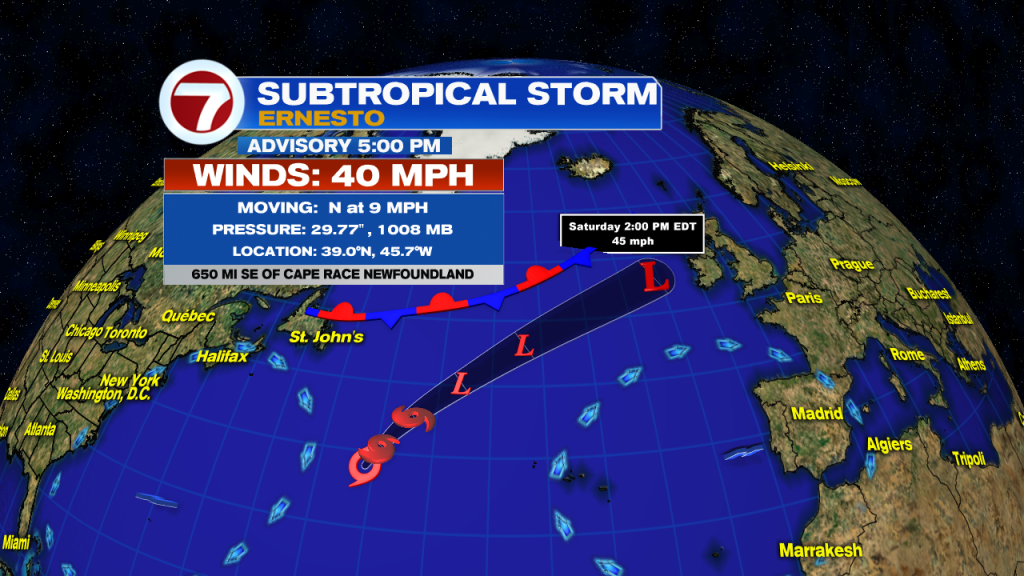
As of the 5 pm advisory on Thursday, Subtropical storm Ernesto remains over the open central Atlantic waters. The life span for this system will be short-lived. While it could strengthen through Thursday morning, models suggest it will be post-tropical by the weekend.
Copyright 2024 Sunbeam Television Corp. All rights reserved. This material may not be published, broadcast, rewritten or redistributed.