Happy Saturday, South Florida!
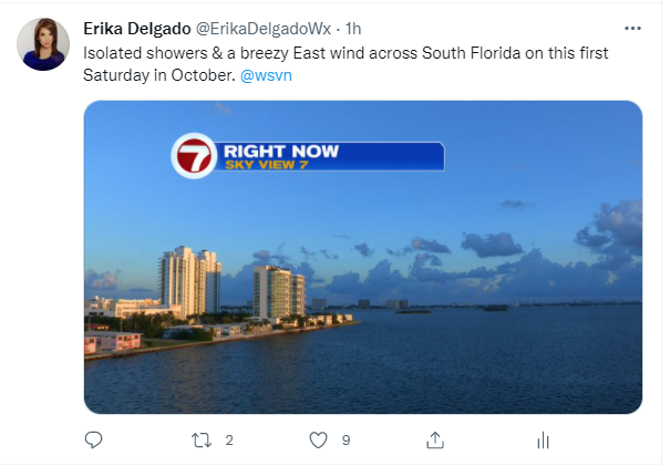
Hopefully everyone had a great week and a nice end to the month of September! It was a nice week overall but then Friday, the first day of the new month, started off a bit on the soggy side for South Florida. The reason? A decaying front offshore together with onshore winds bringing in some moisture across our area. That front brought in a few showers across our area this morning.
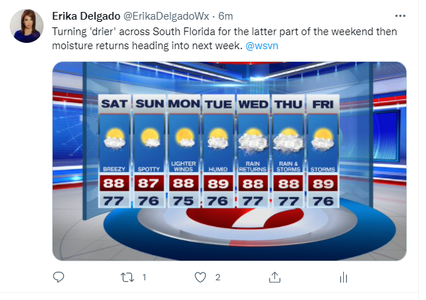
As mentioned above, there is a decaying cold front that we find just offshore and extends into the Upper Keys. To the north of us, high pressure is already beginning to regain control of the weather pattern. That has left South Florida under a tightened pressure gradient, which means breezy conditions are expected throughout the day today. But that also means that we can expect a change for the latter part of the weekend.
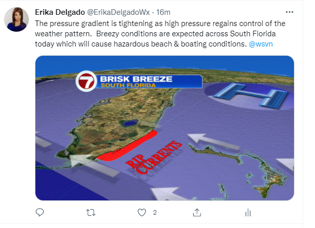
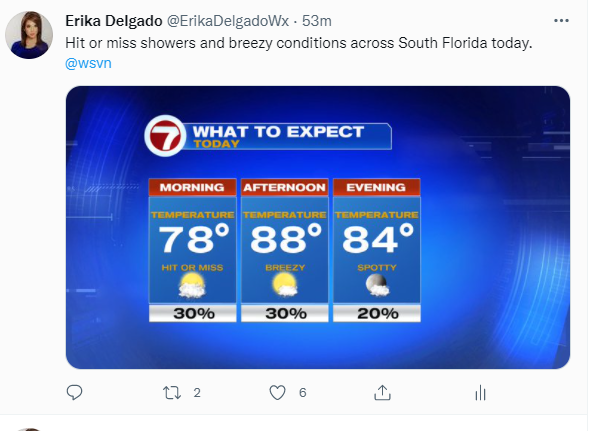
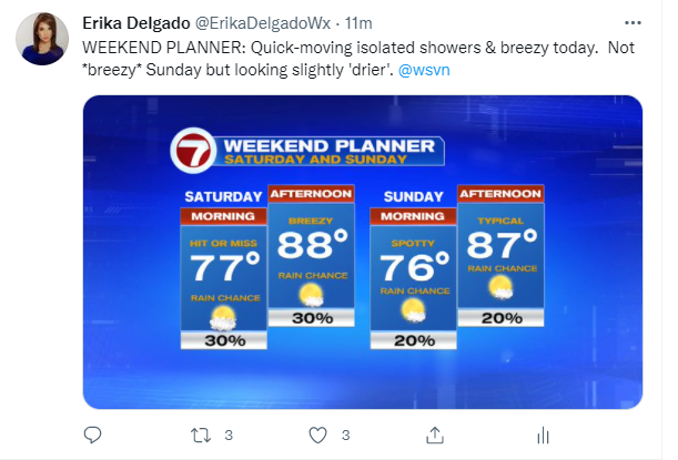
For today we can still expect a few showers coming in along the breeze. Our wind pattern will be out of the East to Northeast anywhere up to 20 mph. Wind gusts today could even reach as high as 25 mph, especially along our coastal locations. Shower chances will be hit or miss today until the slightly drier air that we have been waiting for begins to settle in. We will leave rain chances for the day isolated in nature at about a 30% chance across South Florida.
The latter part of the weekend, as mentioned above, finally brings welcomed changes. Drier air from the Atlantic finally moves in and we can expect lower rain chances and increasing sunshine across our area. As the decaying front (the one mentioned above) fizzles out, and the high-pressure system begins to move offshore, the pressure gradient across South Florida should begin to let up just a bit. However, let it be known that it could still be breezy at times throughout the day on Sunday.
Looking ahead at the start of the workweek does start off on a rather nice note. The dry air looks to stick around throughout the day on Monday before the weather pattern begins to change across South Florida once again. Humidity slowly returns to the forecast by Tuesday ahead of an unsettled weather pattern that we can expect through the second half of the week. An approaching cold front will be entering our state while a disturbance over the Bahamas brings more moisture nearby. This will increase our rain and possibly thunderstorm chances starting Wednesday and that could linger until at least Friday. So enjoy the nice weather that we are expecting because it’s about to feel like Summer once again in the week to come.
Have a great weekend!
Erika Delgado
Meteorologist
WSVN Channel 7 News
Copyright 2024 Sunbeam Television Corp. All rights reserved. This material may not be published, broadcast, rewritten or redistributed.