

Happy Tuesday, April 8, 2025, South Florida!
Hopefully everyone’s week has started off right! Yesterday was a picture perfect day across South Florida as drier air moved in through the second half of the day bringing even more sunshine than we saw during the morning hours. At times, it did feel a little bit on the warm side but even then, it was nice to see those beautiful blue skies! This morning we saw and felt a very big difference as South Florida woke up to mostly cloudy skies, muggy conditions, and warmer temperatures than yesterday. There were also a few showers pushing through the area from time to time.

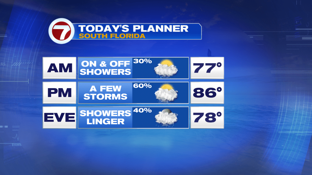
Today will be a mostly unsettled day across South Florida as a front slides into the region. Several rounds of scattered showers and thunderstorms return to the forecast today. And with any storm that were to develop, frequent lightning, gusty winds and the possibility of heavy rainfall will be possible. Unfortunately because the front will be moving so slowly, South Florida will see a few different rounds of showers and thunderstorms, especially through the afternoon as the front gets closer to South Florida.
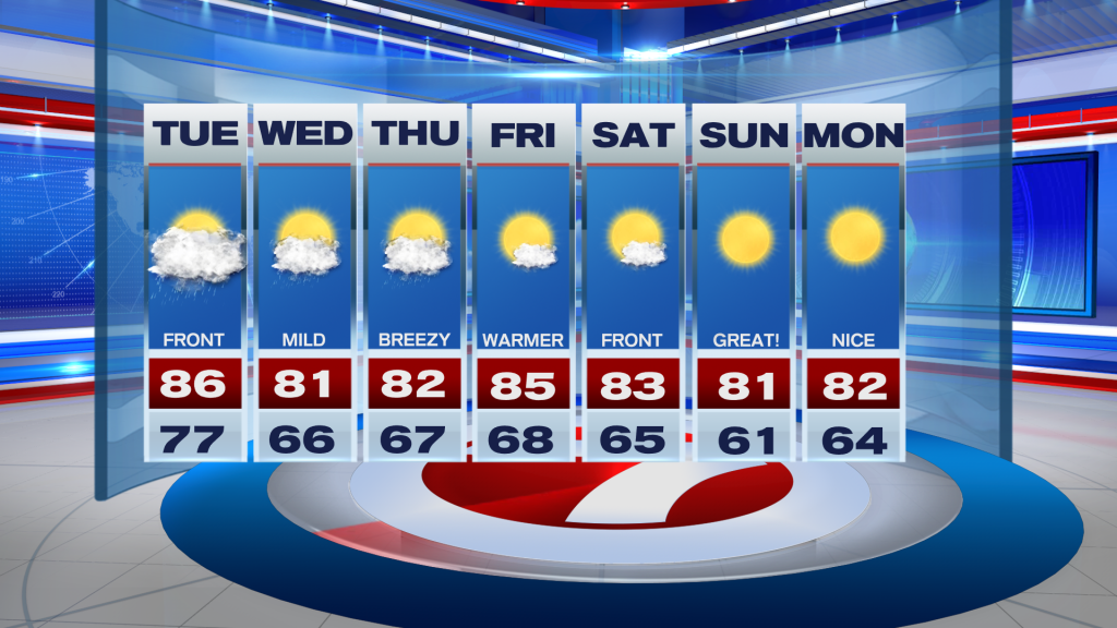
Looking ahead, the above mentioned front will still remain nearby Wednesday. Our wind pattern will be out of the northeast and will pick up speed. The wind will tap into some moisture associated with the nearby front so on-and-off showers will still be possible throughout the day Wednesday even though temperatures will be mild and it will be slightly less humid. Once the Front moisture moves away from the area, South Florida should begin to see an improvement with more comfortable temperatures and even more tolerable humidity levels to end the work week. A brief warm-up will also be possible Friday ahead of another front, that is forecast to reach South Florida (likely dry) late Friday into early Saturday. This will usher in some drier and cooler air for the weekend. And believe it or not, our temperatures could drop into the low 60s for the latter part of the weekend with some inland upper 50s possible Sunday morning!
Don’t forget to keep your rain gear close today!
Erika Delgado
Meteorologist
WSVN / Channel 7 News
Copyright 2026 Sunbeam Television Corp. All rights reserved. This material may not be published, broadcast, rewritten or redistributed.