Happy Saturday, South Florida!
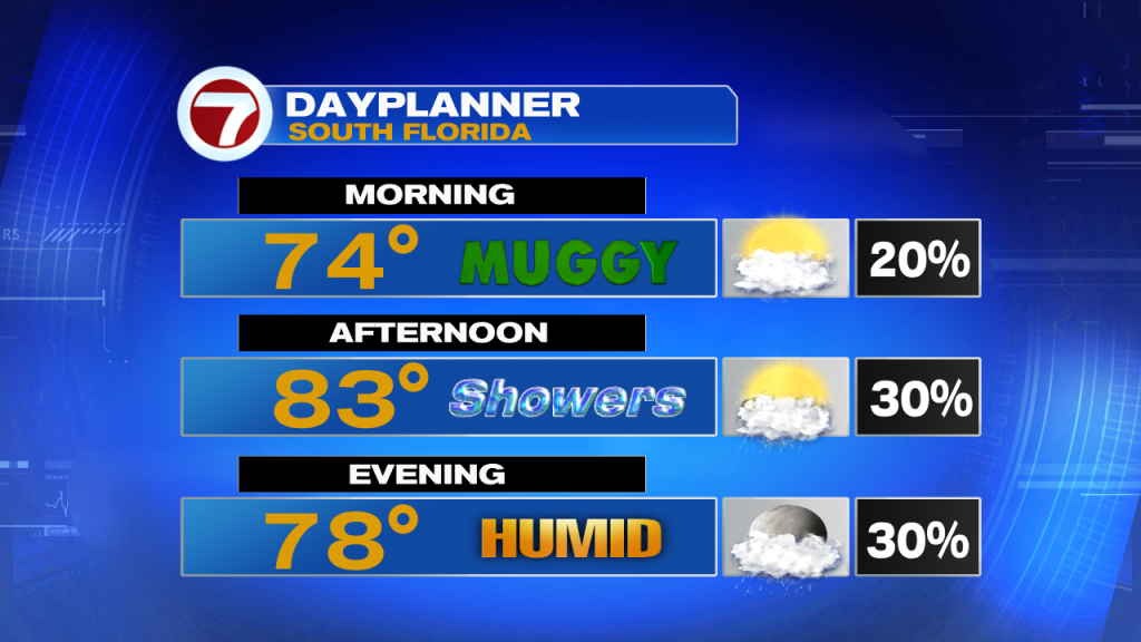
Hopefully everyone had a great week! We are exactly one week away from Christmas day and I’m sure many have last-minute holiday plans and last-minute holiday shopping to get through this weekend. This morning we started off with a few spotty showers and more cloud cover than yesterday. Temperatures were a touch warmer this morning as compared to Friday and wind speeds were lighter than they have been in previous days.
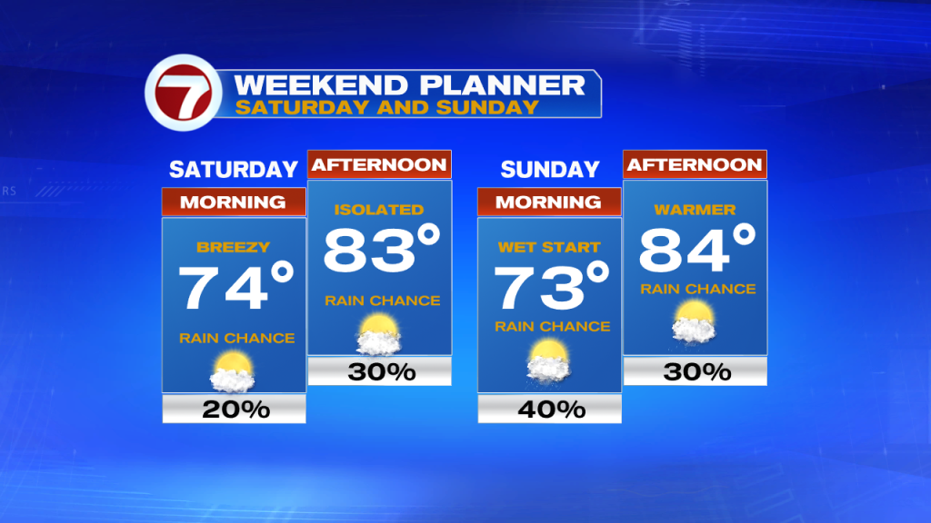
The chance for showers will begin to increase today as high pressure begins to break down, causing an onshore flow to drag in moisture from the Atlantic from time to time. Breezy conditions will still be possible at times (especially along our coastal locations this afternoon), however, we should notice wind speeds gradually decreasing through the weekend. Lighter winds out of the southeast will also help keep temperatures on the warm side. Forecast highs will once again be in the mid to lower 80s.
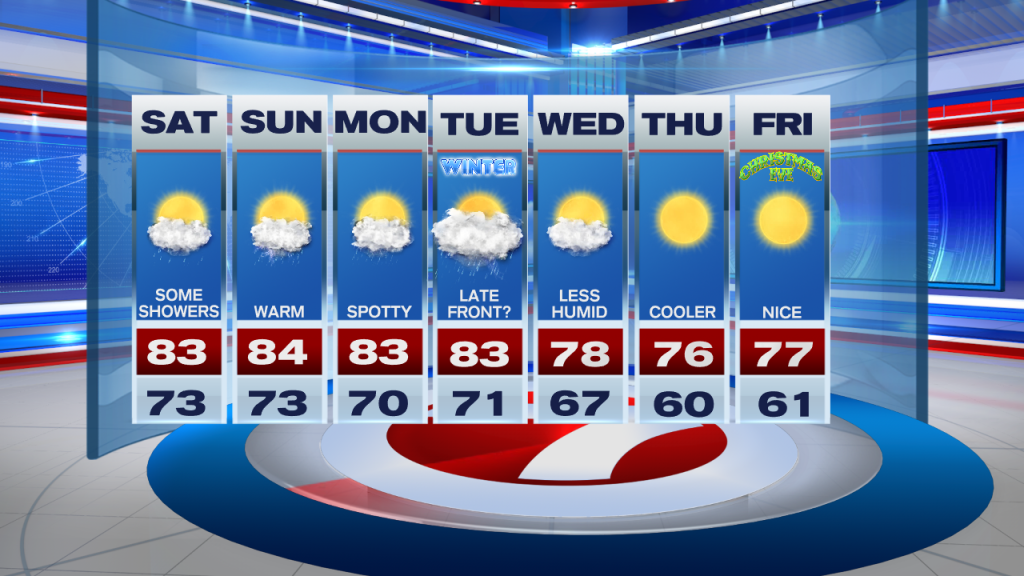
As we head into the end of the weekend, a front will be entering Florida but won’t quite reach our area. This will not only leave South Florida on the warm and muggy side of the front but also will help trap any moisture coming in from the Atlantic over our area. This means that scattered showers will be possible on Sunday and with a front nearby, an isolated thunderstorm or two cannot be ruled out. As our wind pattern begins to veer a bit more out of the south, our afternoon high temperatures will quickly warm into the mid 80s.
A series of fronts will try to reach our area but won’t quite make it, keeping warm and humid conditions over South Florida at least through the middle of next week. However, models are suggesting that there could be a stronger front that finally reaches South Florida by Tuesday (which happens to be the official start of Winter), which will finally bring more of a seasonal feel across South Florida in the days leading into Christmas.
Have a great day!
Erika Delgado
Meteorologist
WSVN Channel 7 News
Copyright 2024 Sunbeam Television Corp. All rights reserved. This material may not be published, broadcast, rewritten or redistributed.