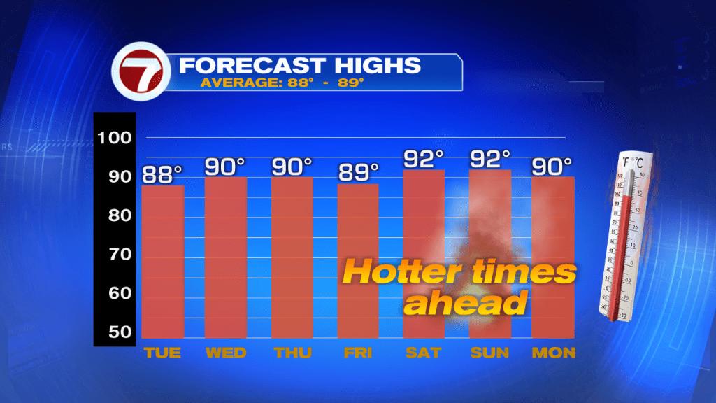
High Pressure will keep the Beaches Breezy and the temps near average for much of the week, By the weekend, the heat moves in pushing the temps into the low 90s.
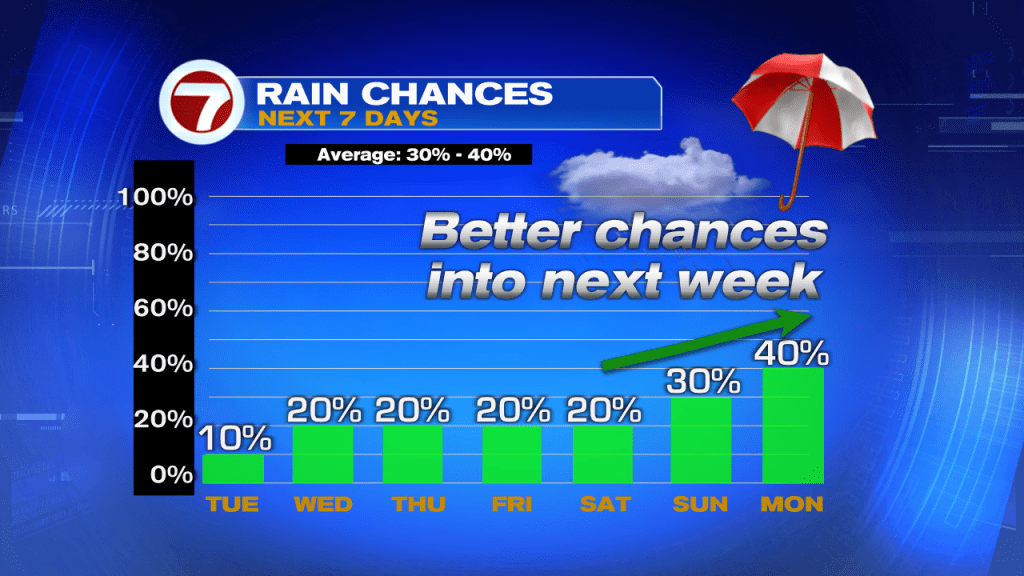
Unfortunately there will be little to no relief in the form of rain, however chances will go back to near typical probabilities by the second half of the weekend and early next week.
In the Tropics
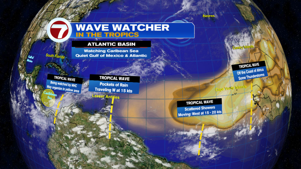
There are a handful of waves in the Atlantic Basin, but most are being kept in check by a huge plume of Saharan Dust. That dusty cloud may reach the Caribbean in a few days making for hazy skies. The dust is also a health concern for folks with respiratory issues. Be alert.
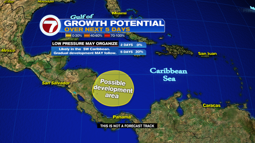
The westernmost disturbance is being watched by the National Hurricane Center for possible development. It has a 30% chance for organization in the area highlighted yellow over a period of 5 days. Even if it doesn’t come together, it will dump plenty of rain over parts of Central America.
A reminder!

On Tuesday, our podcast drops with a look at Pterosaurs in South Florida? A flying lizard that could fit in the palm of your hand or be as big as a small plane. You have a chance to see them, but only for a short time. Plus, the latest on the “Ring of Fire”. No its not in the Pacific Ocean, this one is in the sky… a lunar eclipse and it happens tis week. You can listen to us on Spotify, Apple, or Google Podcasts. Here’s the link https://wsvn.com/weather-or-not/