It was a very wet day across So FL on Wednesday. Many areas had gusty winds, rain, and even street flooding.
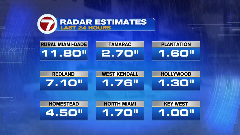
Rain fall totals based on radar imagery showed almost a foot of rain in Rural Miami-Dade, just East of Redland. Better than 7 inches across Redland and 4 and a half in Homestead. The rest of the area ranged between 1 – 3 inches.
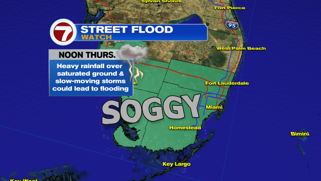
More rain is expected on Thursday with the best chance in the morning. Because the ground is saturated, any additional downpours will lead to standing water. Because of this, NWS Miami has a Flood Watch in place for Miami-Dade and Broward thru noon. Some Saharan Dust is expected to move in Thursday-Friday and that should help dry us out.
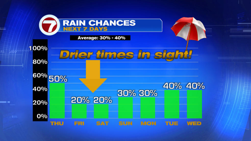
Thursday promises to be soggy but not as wet as the last few days. Looking nice for Friday and Saturday, by Sunday we go back to typical rain chances.
In the Tropics
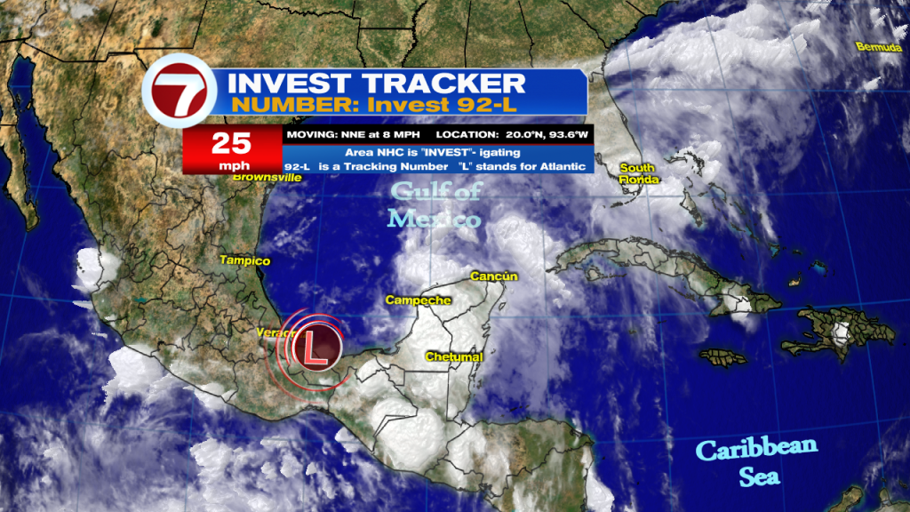
NHC is monitoring an area of disturbed weather in the SW Gulf of Mexico for possible development. It has been deemed Invest 92 L. Invest for an area NHC would like to INVEST-igate further, 92 is a tracking number, and “L” stands for Atlantic Basin. It is forecast to break free from the Mexican Coastline on Thursday and move north. Once in the open waters it gets a high chance for development. It could become a depression on Thursday and aim for the Gulf States. A recon plane is on stand-by to check its health.
We’ll keep watching