
The National Hurricane Center (NHC) is watching two systems on the verge of development on Wednesday.
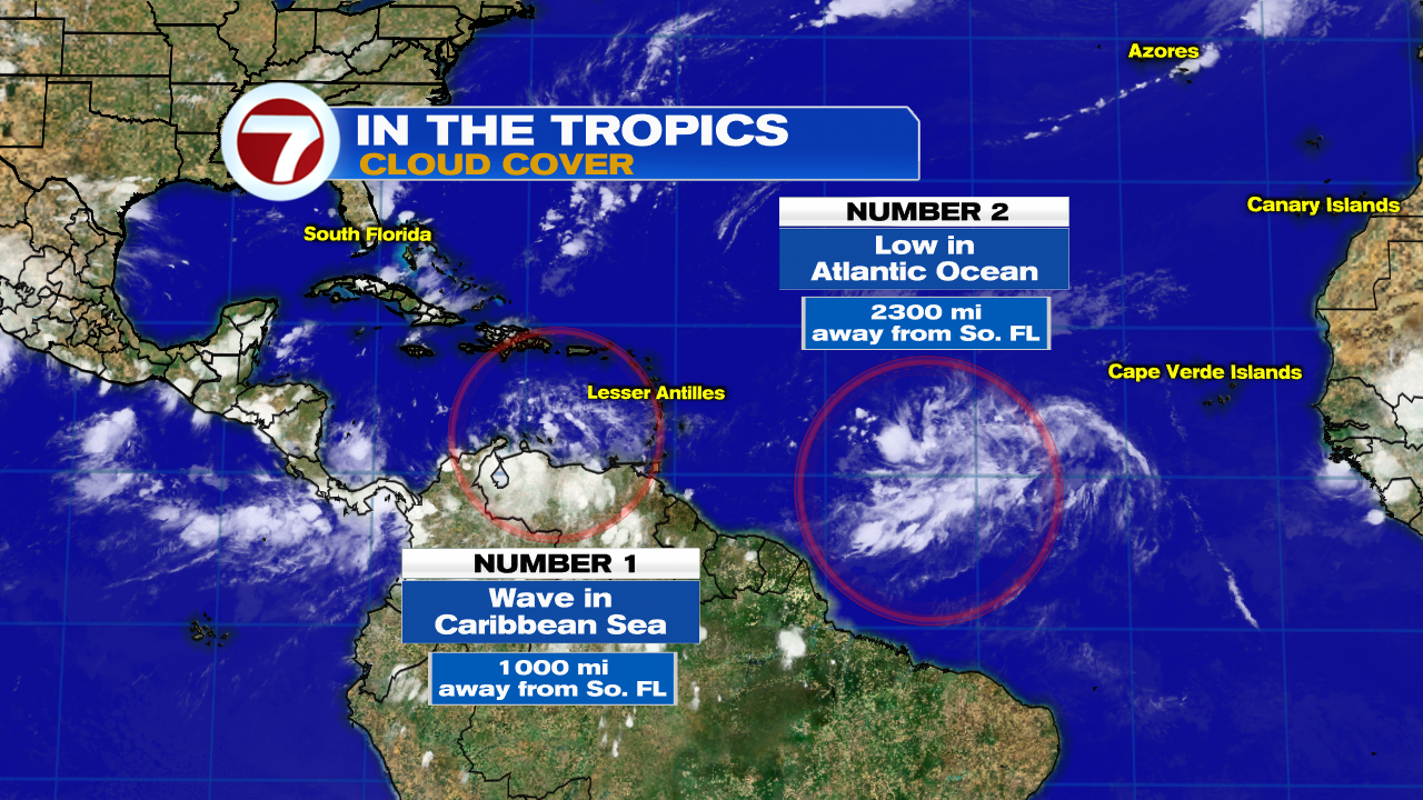
The first is a Tropical wave roughly 1000 miles away from South Florida, and the other is an area of low pressure about 2300 miles away from our area.
Tropical Wave in Caribbean
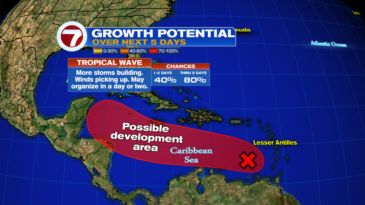
NHC has its chances for development at 80% over 5 days in the area highlighted. A recon plane is on stand-by for Thursday if needed.
Where is it going?
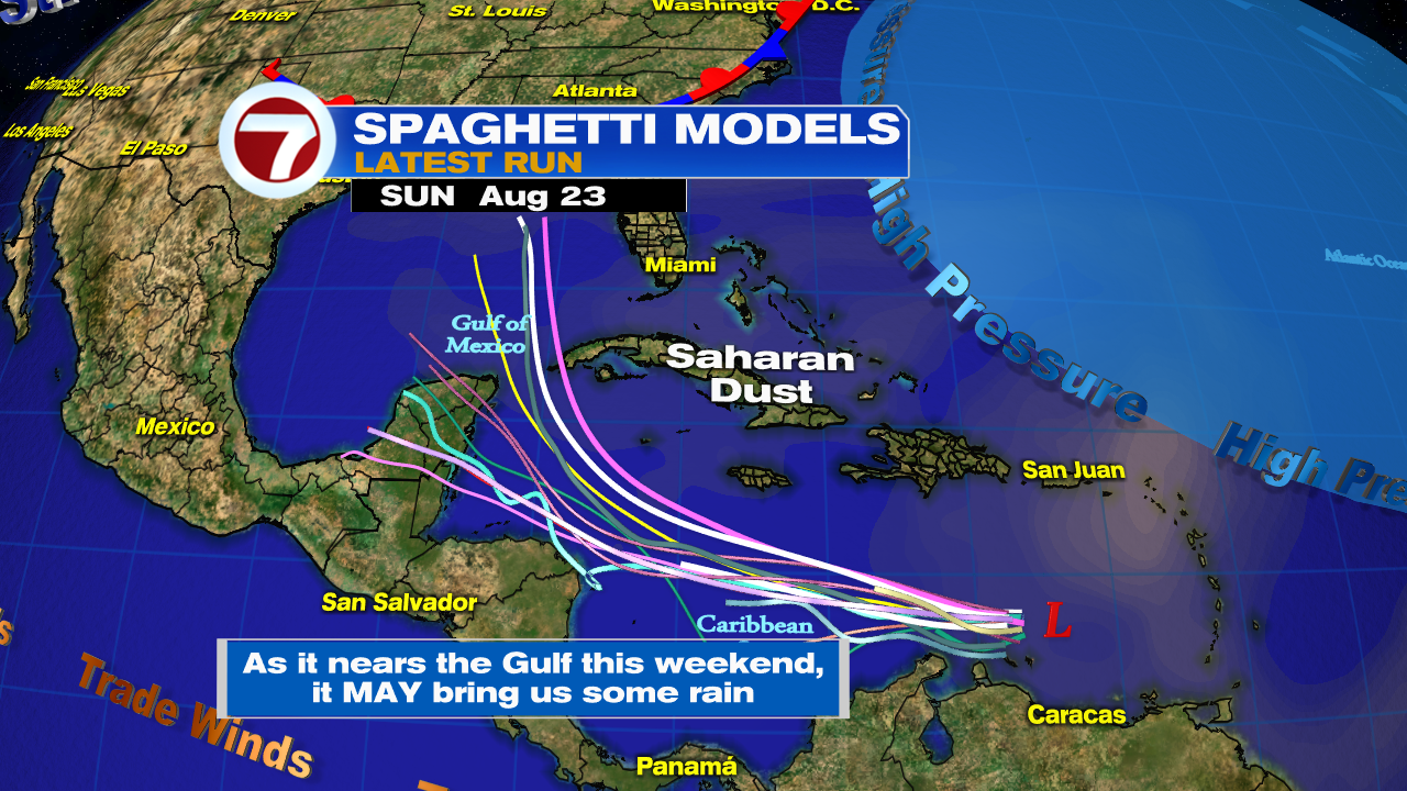
If it were to develop, the models show a westerly track through Friday and then a turn to the north by Saturday. As it nears the Gulf of Mexico, some rain may get spun out and sent to South Florida.
Area in the Atlantic

This area of low pressure Invest98L, has many worried about its future track. For the moment NHC says it may organize in the area shaded red. If it reaches tropical storm status, it will be named Laura.
Where is it going?
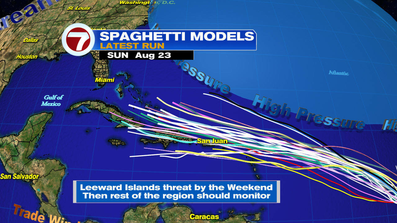
Keep in mind nothing has developed yet. Because of that, models are guesstimating at this point. As of Tuesday night, they were thinking the system could go close to the Leeward Islands by Friday/Saturday. After that, everyone should monitor carefully.
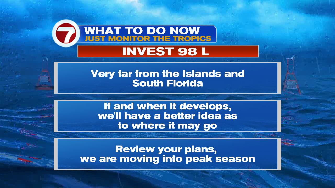
This is a great reminder we are quickly reaching the peak of hurricane season and we should all be prepared in case Mother Nature sends us something. It’s a great opportunity to review your plans and supplies.
We’ll be watching
Copyright 2024 Sunbeam Television Corp. All rights reserved. This material may not be published, broadcast, rewritten or redistributed.