The National Hurricane Center is keeping a close eye on TD 13. It’s proving a bit difficult to forecast how strong it will be down the road.

TD13 is forecast to turn into a Tropical Storm Friday, but after that, its strength remains uncertain. Some models dissolve it into a wave while others intensify it greatly.
Latest from Recon Aircraft
NOAA recon trying to find the center of TD13. Winds remain close to last advisory of 35 mph. Pressure has dropped from 1009 to 1004 mb pic.twitter.com/dcHoyg7rMq
— Phil Ferro (@PhilFerro7) August 21, 2020
What we know:
- Tropical storm force winds and heavy rain are possible across the Northern Leeward Islands by Friday evening.
- Puerto Rico and the Virgin Islands could see conditions deteriorate Friday night into Saturday morning. Watches and Warnings may be issued for you later today.
- If TD 13 does not get any stronger than a tropical storm, it is still capable of heavy and gusty winds across Dom. Republic, Haiti, Turks & Caicos, Bahamas, Cuba & South Florida over the weekend.
Model Woes
The atmosphere surrounding TD 13 appears favorable for further strengthening with light to moderate shear (strong upper level winds that could keep it in check). It’s also traveling over warm waters.
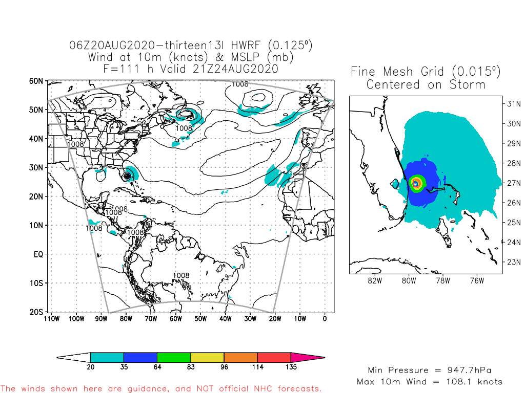
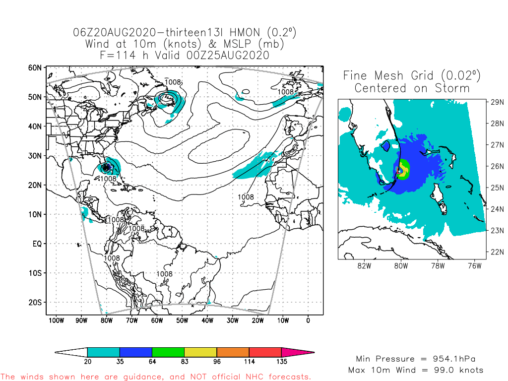
Some models like the HWRF (Hurricane Weather Research & Forecasting) and HMON (Hurricanes in a Multi-scale Ocean Non-hydrostatic) show TD13 reaching major hurricane status in 5 days.
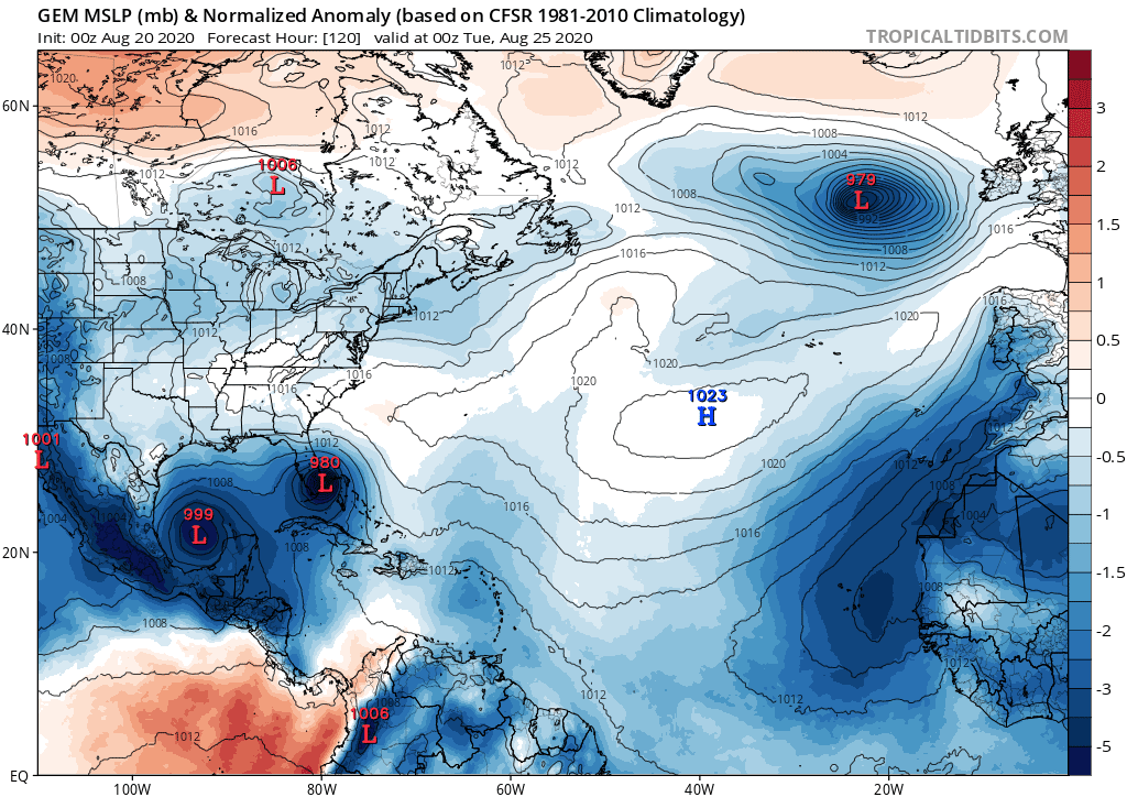
The UKMET (United Kingdom Meteorological Agency Model) and the Global Environmental Multi Scale aka Canadian model, keep it as a storm
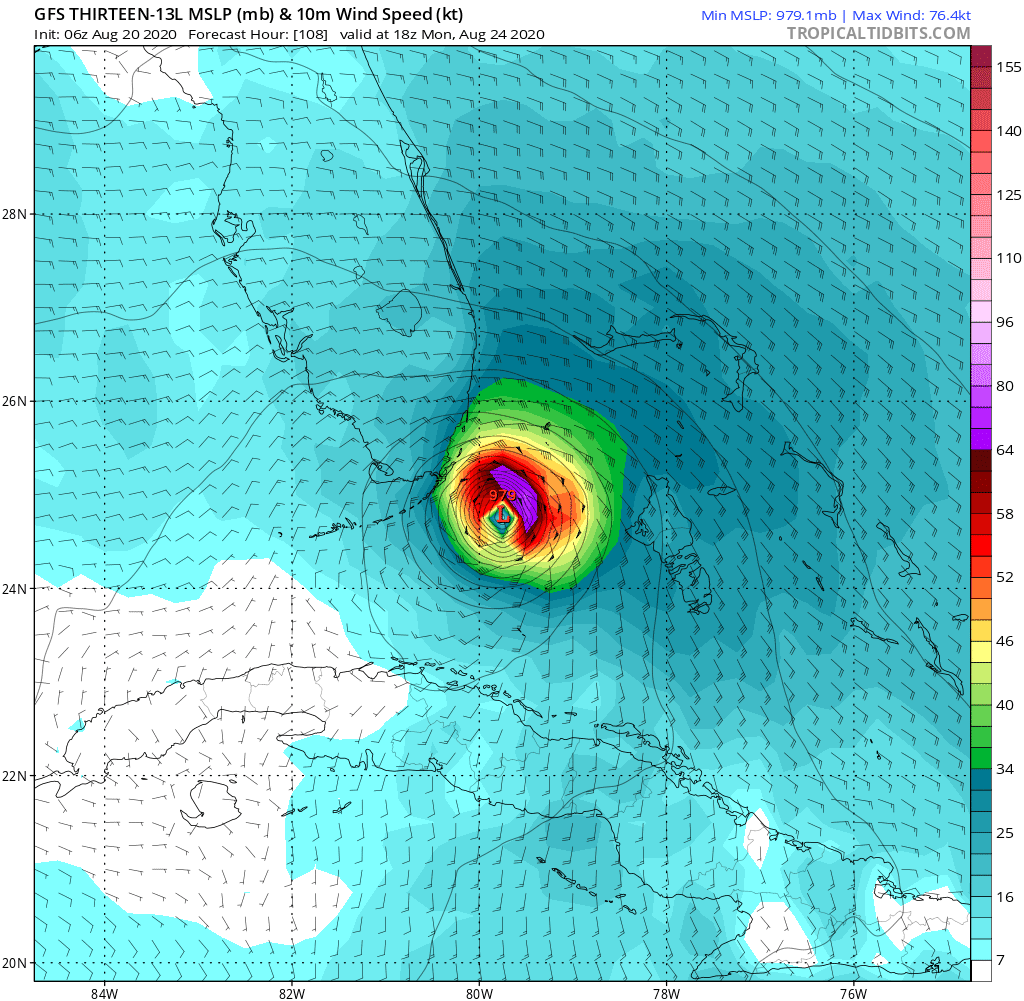
The GFS (Global Forecasting System) is insisting on a stronger solution with the system near South Florida by Monday.
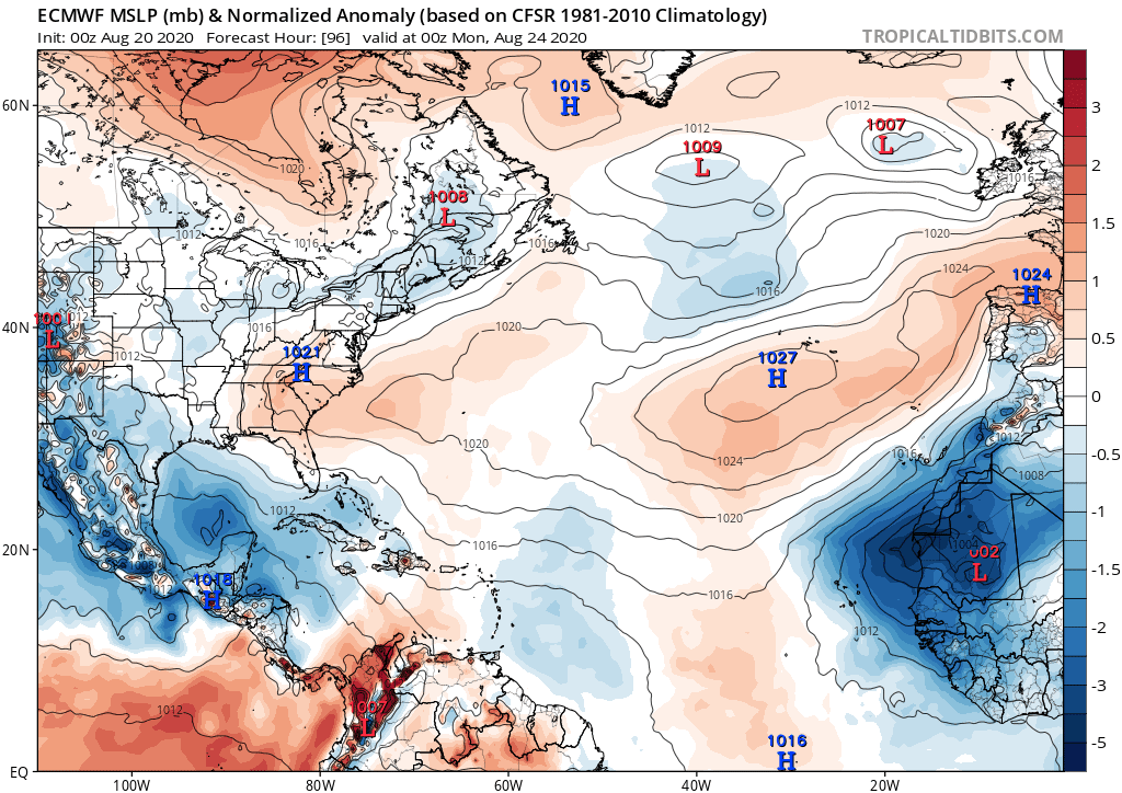
The ECMWF (European Centre for Medium Range Weather Forecasts) weakens the system to just a tropical wave. This downward trend could be because of dry air getting in its path from some Saharan Dust. It also suggests high pressure to be fairly strong and possibly push the system south of South Florida and into the Gulf. We are hoping this scenario pans out.
Bottom Line: The islands needs to monitor closely. Pay attention to your local authorities. South Florida needs to stay alert. The possibility is high that we may see a tropical system over us late in the weekend or Monday. Unsure how strong it may be.
Historical Look
IF both TD 13 & 14 become storms and move along their forecast paths, they could eventually come within 500 miles of each other next Tuesday. Also they could make landfall with 24 hrs of each other. The last time that happened was 1933. pic.twitter.com/SjDBC3WKsN
— Phil Ferro (@PhilFerro7) August 21, 2020
.
Copyright 2024 Sunbeam Television Corp. All rights reserved. This material may not be published, broadcast, rewritten or redistributed.