Rounds of rain are in our Thursday forecast as deep tropical moisture continues to surge in our direction.

As the day progresses, the cloud cover will build even more and bring numerous to scattered showers and storms our way by the afternoon. This is all from an area of disturbed weather over the Caribbean Sea seeping into the Atlantic.
The National Hurricane Center is also monitoring this feature. Models suggest a low could form over the next couple of days. It has a medium chance for development over the next 5 days before a dig into the jet stream makes conditions less favorable. Regardless of development, this will be a rainmaker for South Florida into the weekend.
Area of clouds & rain has a medium chance for development. Regardless, rainmaker for Florida @wsvn @7weather #flwx pic.twitter.com/YqCDe0ii8t
— Miss Chavis (@karlenechavis) September 28, 2017
In addition to the Caribbean moisture, a front will move towards northern Florida by Friday. It is expected to stall out over the Sunshine State and trap the tropical moisture over us. This will lead to round of rain and high chances of anytime downpours for the weekend and into next week.
TROPICS
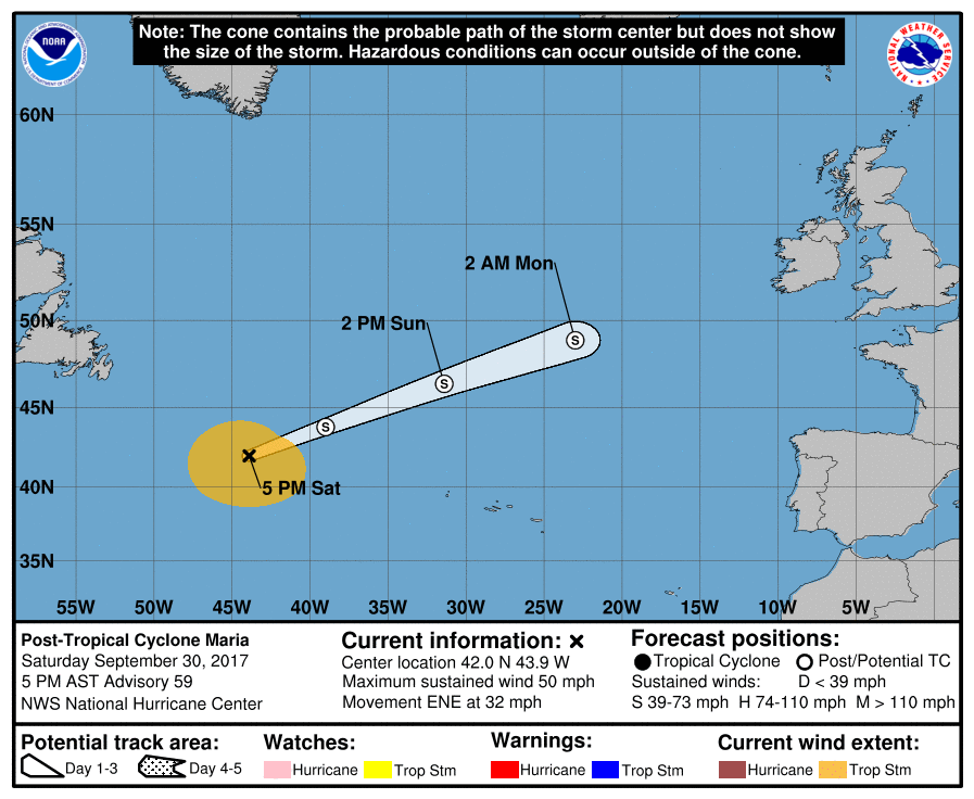
Maria will continue to head out to sea over the open Atlantic waters. All coastal watches and warnings have been lifted. Hazards are still being felt with swells generated by Maria affecting much of the east coast of the United States, Atlantic Canada, and Bermuda.
Lee remains over the open waters of the Atlantic Ocean. No threat to land as well. Hazard for the shipping lanes.

Copyright 2024 Sunbeam Television Corp. All rights reserved. This material may not be published, broadcast, rewritten or redistributed.