Happy New Year!
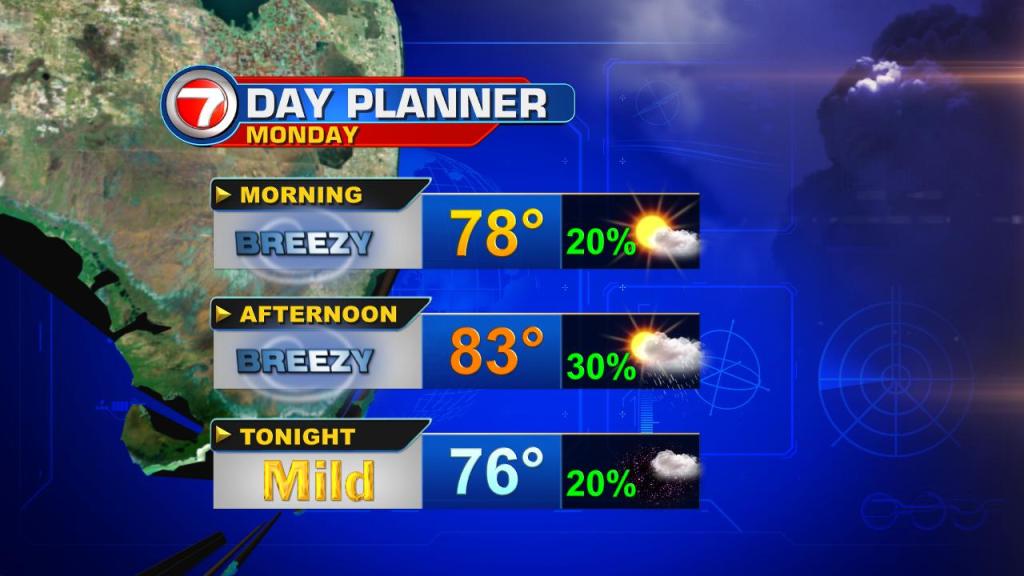
The southeast breeze that quickly warmed our temperatures above the norm to kick off 2017 will hold steady through tonight. This will translate to coastal clouds with an isolated shower or two and mild overnight temps back in the low to mid 70s.
Patchy fog is also possible over the inland areas where clearer skies will prevail through Monday morning.
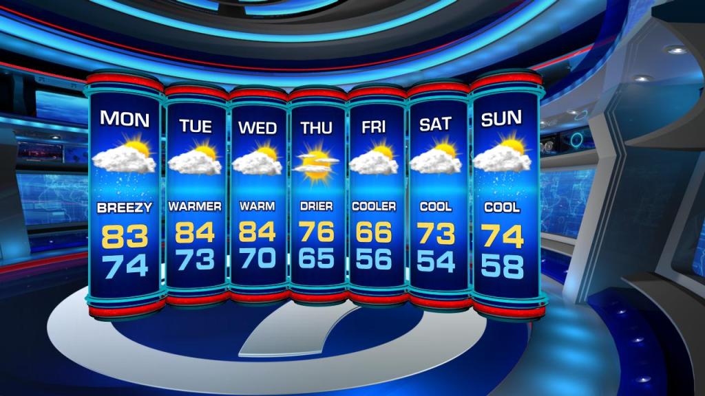
As we start off the first week of 2017, the weather will feel more like throwback to more summer-like heat.
Expect humidity to rise as winds calm down and daytime highs peak in the mid 80s through Wednesday. This will be ahead of the next cold front to swing through the Sunshine State.
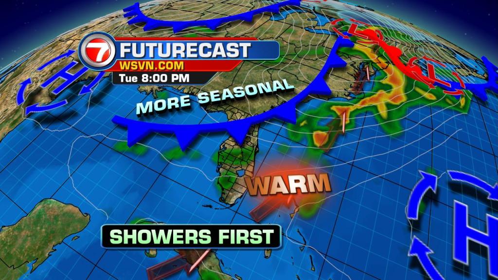
Models are suggesting this next system will leave us on the cooler side by the start of next weekend.
While this could change the closer we get to Friday, overnight lows look to be slipping back into the 50s starting Friday morning. We just have to wait and see if this holds.
Copyright 2024 Sunbeam Television Corp. All rights reserved. This material may not be published, broadcast, rewritten or redistributed.