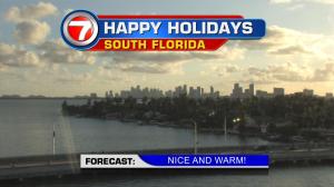
A warm weather record is well within reach for parts of south Florida on Sunday afternoon. As it stands now, the warmest Christmas Day (since records have been kept) is 85 degrees for Miami, back in 1941. The record is in jeopardy as warm weather continues to filter into the entire region. The weather map is going to look very familiar to Floridians over the next several days. Sturdy high pressure will hold together well north of our state. That pattern will force local winds off the Atlantic Ocean where we could see a passing shower along the breeze. Since no cold fronts are expected to penetrate the high, temperatures will be status quo… and well above average. In many cases, readings could be 10 to 15 degrees above normal! Looking well in advance, many long range forecast maps show high pressure shifting east and weakening gradually over the coming week. As that happens, the next chance for a cold front to possibly dive into our region will be from Friday through Saturday (just prior to New Year’s Eve). It’s too early to determine the extent of potential cooling, but a 10-degree drop seems reasonable. That would take us back to more typical weather to round out the year.