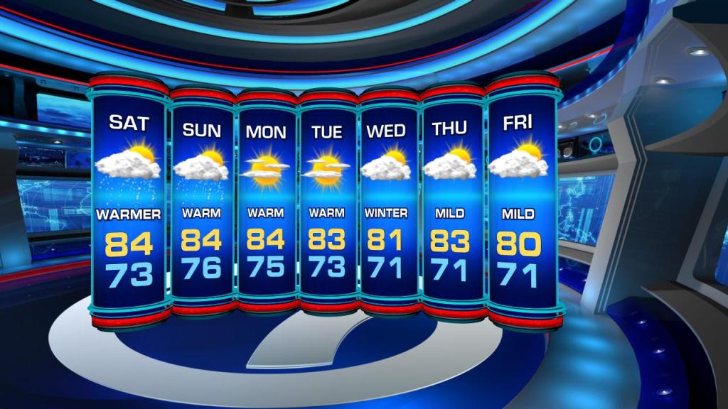
Temps will start to climb away from the seasonal range as a more summer-like feel returns for the last weekend of Fall.

High pressure over the Western Atlantic will aid in our near record weekend temps. Expect daytime highs in the mid 80s and overnight lows in the low to mid 70s.
For Saturday, the forecast high is 84° and the record stands at 85° set back in 1965. So Flo temps, about 10-15°, above the normal will remain in the forecast through Monday.
Additionally, the approach of a weakening cold front will generate a seabreeze for our Saturday and Sunday. Southeast winds could push isolated showers our way under partly sunny skies.
The winds will also rough up the surf and seas. There is a high risk of rip currents at our local beach. A Small Craft Advisory is also in place for the Florida Keys, while boaters in Miami-Dade and Broward waters are suggested to use caution on Saturday.

No major changes are expected through the final days of Fall. We’ll see spotty showers ahead of the cold front and a return to more seasonal temps for the first day of Winter on Wednesday.
Copyright 2024 Sunbeam Television Corp. All rights reserved. This material may not be published, broadcast, rewritten or redistributed.