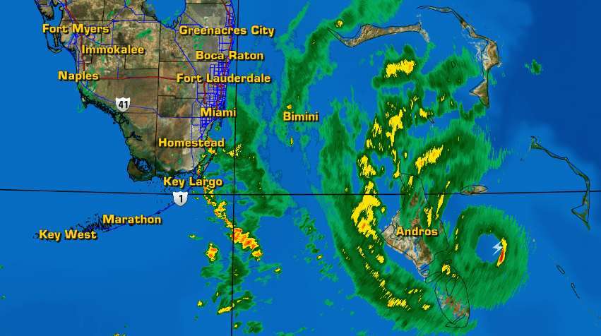
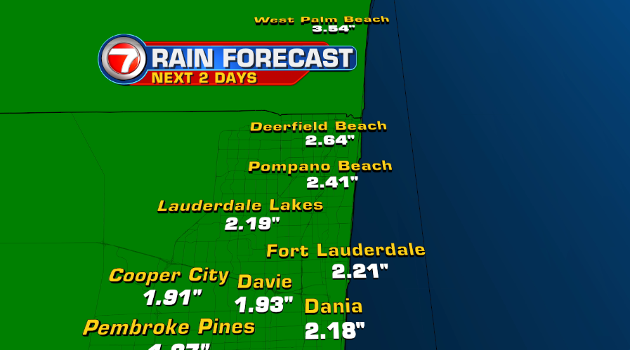
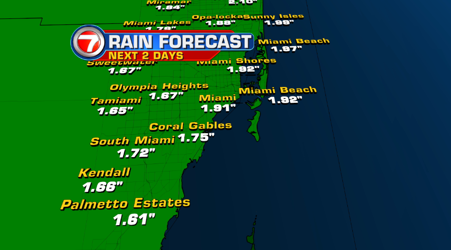
Shutters are up, cabinets are stocked with food, and other necessary items are ready for use. As preparations for Hurricane Matthew should have been done on Wednesday, we find ourselves on Thursday watching and waiting for this storm to pass. Bands of heavy rain are getting closer to the coast with winds picking up quickly. Later in the afternoon, sustained winds are expected to reach 60 mph or higher. Rainfall is also forecast to effect Broward and Miami-Dade through Friday.
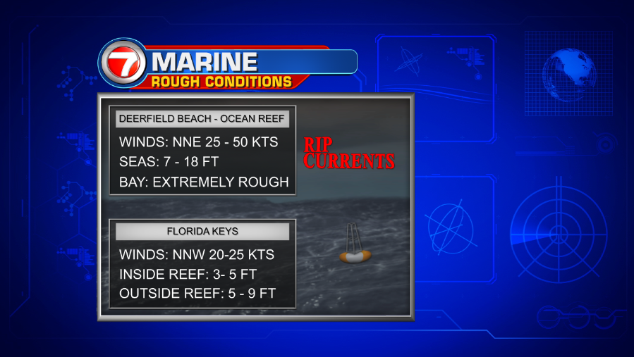
Apart from the wind and the rain, marine conditions will be extremely rough and in no shape for boaters/swimmers. Hazards include a high risk of rip currents and building seas up to 18 feet. Stay away!
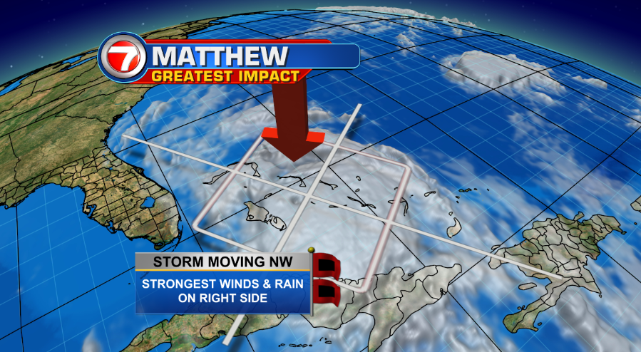
As Matthew continues to travel Northwest, its “dirty sector” is on the right side of the storm. This does not mean conditions in south Florida won’t be deteriorating. This is a major hurricane after all! While tropical storm force winds will definitely be felt with this system. hurricane force winds are forecast to reach Broward and possibly northeast Miami-Dade.
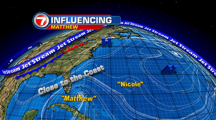
What is influencing Matthew? From upper-level winds not dipping in time to high pressure systems keeping the storm in check, this hurricane will continue its trek very close to the East coast of Florida.
The cone of concern then shows Matthew possibly impacting central Florida by Friday morning.
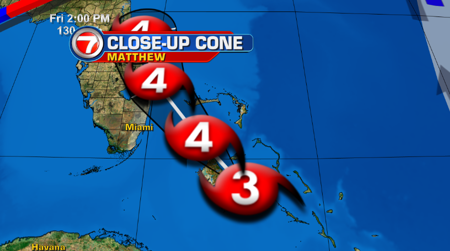
Will Matthew come back for more? Models are showing a loop back around in the next 5 days. Only time will tell if this holds true.

Please stay tuned to your Storm Station for the very latest on Hurricane Matthew.
Meteorologist Natacha Galindo
Weather Producer