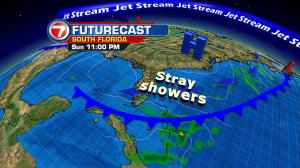
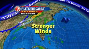
You could say “things are looking up” in our south Florida weather. That applies to higher wind speeds and rising temperatures as we round out the month of November. For now, high pressure is building into Florida from the western Atlantic. As the high continues to strengthen, we’ll notice that our ocean breeze gets more gusty. Marine conditions will become unfavorable for swimming and boating. Expect dangerous rip currents (a high threat) along with small craft advisories to continue for boaters. Overall, winds won’t subside until Thursday (although the effect of the wind will be less noticeable away from the coast). Warmer air is also on the horizon. The main surge will happen as the air flow turns out of the south from Tuesday through Wednesday. That will lead to readings a good 5 degrees warmer than normal. Also, since humidity will also be getting a bump, it won’t feel much like “the holidays” across the region.


