By BARBARA RODRIGUEZ
Associated Press
DES MOINES, Iowa (AP) — Severe weather packing large hail and heavy rain rolled into Nebraska and Iowa on Tuesday as potentially dangerous storms targeted a swath of the Midwest, including states where voters were casting ballots in primary elections.
The National Weather Service said reports of hail damage and flooding have begun to trickle in as storms pushed into Nebraska and continued eastward.
Officials said the highest risk for severe weather was centered in parts of eastern Nebraska, western and southern Iowa, and northeast Missouri. Officials said there was the potential for a weather event called a derecho, which is a storm of strong straight-line winds spanning at least 240 miles.
“This is one of these days we can’t let our guard down,” said Bill Bunting, forecast operations chief at the Storm Prediction Center in Norman, Oklahoma. “It’s unfortunately panning out as we thought it would. This is shaping up as a very dangerous evening.”
The outbreak of severe thunderstorms has already affected parts of northern and eastern Nebraska, where residents in Norfolk and Blair reported homes and vehicles damaged by large hail. Terry Landsvork, an observation program leader for the National Weather Service in Valley, Nebraska, said the severe weather is forecast into the evening and early hours of Wednesday.
Landsvork said on Interstate 29 north of Council Bluffs in western Iowa, more than 25 vehicles had their windows shattered by hail.
“They were driving along Interstate 29, had no place to go, and whether they were driving or pulled over, they just didn’t escape the hail,” he said.
Winds of up to 85 mph were also reported in some parts of Iowa. Up to 4 inches of rain was expected.
In Nebraska, weather officials said at least one severe thunderstorm capable of producing a tornado was reported near the city of Fullerton. A similar thunderstorm was reported in the western Iowa community of Elliot. Officials say they won’t be able to confirm if there were any tornadoes for several hours.
The storms also are expected to affect parts of Illinois, Kansas and South Dakota.
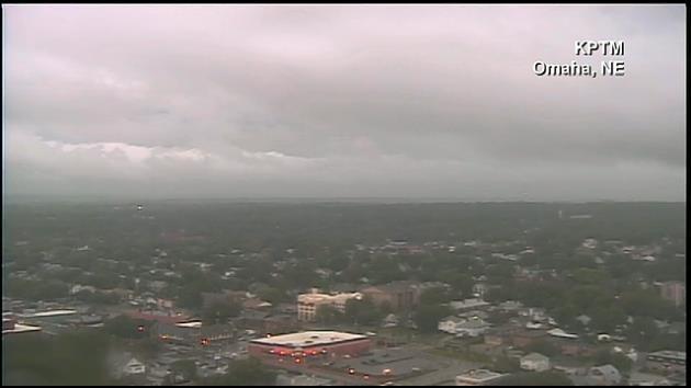
Heavy rain in the Omaha area has caused police to assist drivers stranded in floodwaters. Officers are also patrolling roads to replace blown off manhole covers, and officials closed Eppley Airfield airport.
“There was big ice on the ground. Nothing but ice,” said Omaha resident Shuree Stephens. “It’s hasn’t been like this in a long time.”
The bad weather had an impact on the primary elections in Iowa, where some officials and voters were forced to seek shelter in Pottawattamie County around 5 p.m. County Auditor Mary Jo Drake said operations have been suspended in about 10 precincts out of 40. There were no reports of injuries. Montgomery County closed and evacuated polls around 6 p.m.
“It’s nasty here, you can’t imagine,” Drake said. “It’s as black as the ace of spades.”
Iowa Secretary of State Matt Schultz had encouraged residents to vote early due to the expected severe weather.
In South Dakota, a thunderstorm forced Senate candidate Mike Rounds, who was flying to Rapid City, to land in Pierre. Secretary of State Jason Gant said he hopes the weather doesn’t hurt voter turnout, but he wants people to be safe.
Bunting said Iowa residents planning to vote Tuesday should be cautious about when they head out to the polls.
“There may be in many areas time to go out and do things before the storms hit. I think the main thing is to listen to the forecast, get some sense of when storms are likely in your area and just make sure you’re in a safe place before the storms hit,” he said.
The severe weather threat arrives amid an unusually quiet late spring, with far fewer documented tornados in May than in many recent years. Bunting said the current system could be most severe because of widespread straight-line winds.
“As we like to say, it doesn’t have to rotate to be dangerous,” he said.
Copyright 2014 The Associated Press. All rights reserved. This material may not be published, broadcast, rewritten or redistributed.